Assam Mission Basundhara 4: First land resurvey since 1960s to cover 18,000 villages

Synopsis
Assam is about to do something it has not done in over 60 years: resurvey every village in the state. Mission Basundhara 4, launching on 25 December, will deploy GNSS technology across 18,000 villages over four years — a ground-up remap of land ownership that could reshape property rights, reduce disputes, and test whether digital governance can finally catch up with ground realities in one of India's most land-sensitive states.
Key Takeaways
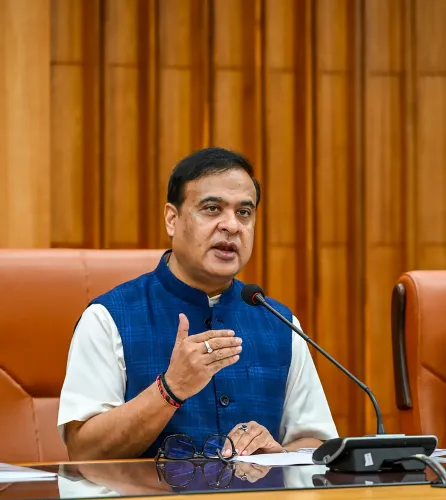
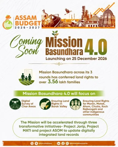
Mission Basundhara 4 will launch on 25 December , announced by Assam Chief Minister Himanta Biswa Sarma .
Assam will conduct its first comprehensive land resurvey since the 1960s , covering nearly 18,000 villages over four years .
The survey will use advanced GNSS technology to ensure land records reflect ground realities.
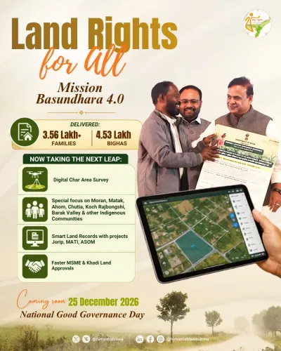
Three sub-projects — Project JORIP , Project ASOM , and Project MATI — form the mission's foundation.
The mission also includes complete digitisation of land records and a GIS-based property valuation mechanism.
Land registration services will be simplified through a citizen-centric model for faster, more transparent transactions.
Assam Chief Minister Himanta Biswa Sarma on Friday announced that the state government will launch Mission Basundhara 4 on 25 December, initiating Assam's first comprehensive land resurvey in over six decades. The exercise will span nearly 18,000 villages across the state over a four-year period, deploying advanced Global Navigation Satellite System (GNSS) technology to align official land records with ground realities.
What Mission Basundhara 4 Covers
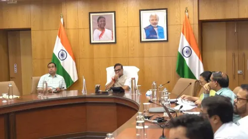
Chief Minister Sarma shared the details in a post on social media platform X, stating that the mission will rest on three foundational projects: Project JORIP, Project ASOM, and Project MATI. He said he had held a detailed review meeting with senior officials on all three initiatives ahead of the formal launch.
Beyond the physical resurvey, the mission will pursue complete digitisation of land records and introduce a Geographic Information System (GIS)-based land valuation mechanism designed to bring uniformity and transparency to property valuation across the state.
Why This Resurvey Matters
The last systematic land survey in Assam dates to the 1960s — meaning current records are more than 60 years out of date. Long-pending discrepancies in land ownership records have fuelled disputes, complicated property transactions, and created governance blind spots in a state where land identity is deeply tied to cultural and political life.
Sarma framed the initiative within the government's stated vision of protecting Assam's 'Jati, Mati and Bheti' — a phrase translating to identity, land, and heritage — signalling that the reform carries both administrative and political weight.
Modernising Land Administration
The mission also aims to overhaul the citizen experience of land services. The state government intends to simplify land registration procedures by adopting a citizen-centric model that would make property transactions faster, more transparent, and more reliable.
The integration of GNSS surveying, GIS-based valuation, and digital record-keeping represents a significant technological leap for Assam's revenue administration, which has historically relied on manual, paper-based systems prone to error and manipulation.
Mission Basundhara: A Continuing Initiative
Mission Basundhara is one of the Assam government's flagship land governance programmes, with earlier phases focused on resolving land-related issues through technology-enabled reforms and streamlined public services. The fourth phase is positioned as the most ambitious iteration yet, extending the scope from dispute resolution to a ground-up re-mapping of the state's land ownership landscape.
With the launch set for 25 December and the four-year survey window ahead, the coming months will test whether the government can translate the scale of the ambition into measurable on-ground outcomes.
Point of View
000 villages is administratively ambitious by any measure, but the real question is sequencing: GNSS surveys generate data; what matters is whether the adjudication machinery — revenue courts, district collectors, grievance redress — can absorb the disputes that updated records will inevitably surface. Assam's land question is also inseparable from its demographic politics, and any resurvey that uncovers large-scale encroachments or record mismatches will generate pressure far beyond the revenue department. The government's framing around 'Jati, Mati and Bheti' signals that it understands this — but framing and execution are different disciplines. The earlier three phases of Mission Basundhara delivered incremental gains; Phase 4's success will be measured not by villages surveyed but by disputes resolved.
NationPress
1 Aug 2026
Frequently Asked Questions
What is Mission Basundhara 4?
Mission Basundhara 4 is the fourth phase of Assam's flagship land governance initiative, set to launch on 25 December. It will conduct the state's first comprehensive land resurvey since the 1960s, covering around 18,000 villages over four years using GNSS technology, alongside full digitisation of land records and a GIS-based valuation system.
When was Assam's last land survey conducted?
Assam's last systematic land survey was carried out in the 1960s, making the upcoming resurvey the first comprehensive exercise of its kind in more than six decades. The gap has led to significant discrepancies in land ownership records across the state.
What technology will be used in the Assam land resurvey?
The resurvey will deploy advanced Global Navigation Satellite System (GNSS) technology to capture precise land boundary data. A Geographic Information System (GIS)-based mechanism will also be introduced for scientific land valuation.
What are Project JORIP, Project ASOM, and Project MATI?
These are three sub-projects that form the foundation of Mission Basundhara 4, as outlined by Chief Minister Himanta Biswa Sarma after a review meeting with senior officials. Specific details on each project's scope have not yet been made public beyond their role in supporting the broader mission.
Who will be affected by the Assam land resurvey?
Residents across nearly 18,000 villages in Assam will be affected, particularly those with long-pending disputes over land ownership. The mission also aims to simplify land registration for all citizens, making property transactions faster and more transparent.