Bihar Yellow Alert: MeT flags heavy rain in 25 districts on 31 July

Synopsis
Bihar's monsoon has turned sharply uneven — the north is bracing for thunderstorms under a Yellow Alert covering 25 districts, while the south swelters in heat and humidity. Behind the weather warning lies a deeper worry: the state has received 42 per cent less rain than normal this season, and farming communities are watching the skies with growing anxiety.
Key Takeaways
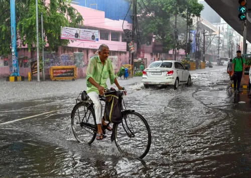
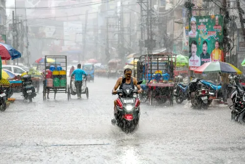
The Meteorological Department issued a Yellow Alert for 25 Bihar districts on 31 July , warning of thunderstorms, lightning, and heavy rain.
Wind speeds in affected areas could reach 40 kmph ; the strongest impact is expected across North Bihar , eastern Bihar , and the Seemanchal region .
South and central Bihar , including Patna , are expected to remain relatively stable with low probability of heavy rain.
Buxar logged the state's highest temperature in the past 24 hours at 36.5°C .
Bihar has recorded only 288 mm of rainfall against an expected 494.8 mm — a deficit of 42 per cent — raising concerns for the kharif crop season.
The Meteorological Department has issued a 'Yellow Alert' for 25 districts in Bihar on 31 July as monsoon activity intensified across the state, warning of strong thunderstorms, lightning, and heavy rainfall with wind speeds potentially reaching 40 kmph. The alert comes as Bihar continues to grapple with an uneven monsoon that has left the state with 42 per cent less rainfall than normal so far this season.
Districts Under Alert
The weather warning is concentrated across North Bihar, eastern Bihar, and the Seemanchal region. Districts covered include West Champaran, East Champaran, Gopalganj, Siwan, Saran, Muzaffarpur, Vaishali, Sheohar, Sitamarhi, Madhubani, Darbhanga, Samastipur, Supaul, Saharsa, Madhepura, Araria, Kishanganj, Purnea, Katihar, and Khagaria. Rain and thunderstorms are additionally expected in Kaimur, Munger, Bhagalpur, Banka, and Jamui.
Authorities have urged residents in affected areas to avoid open spaces during thunderstorms, stay away from trees and electric poles, and seek shelter in sturdy buildings — particularly when lightning activity is reported.
South and Central Bihar See Relative Calm
In contrast, weather conditions across south and central Bihar — including the state capital Patna — are expected to remain comparatively stable. The capital may see intermittent cloud cover, but the probability of heavy rainfall is considered low. High humidity combined with strong sunshine is likely to make conditions uncomfortable, though isolated evening drizzle could provide some relief.
Similar conditions are anticipated in Gaya, Nalanda, and Nawada. Buxar recorded the state's highest maximum temperature over the past 24 hours at 36.5 degrees Celsius, followed by Bhojpur at 36.3°C, Patna at 35.9°C, and Aurangabad at 35.8°C.
Why the Monsoon Is Uneven Across Bihar
Meteorologists attribute the patchy distribution of rainfall to varying intensities of monsoon winds across the state. Moist winds originating from the Bay of Bengal are reaching northeastern Bihar more directly, driving greater cloud formation and heavier precipitation. As the monsoon flow moves towards south-central Bihar, however, it weakens considerably — leaving those districts exposed to intense afternoon heat and high humidity, with only localised cloud development and occasional showers.
Rainfall Deficit Raises Alarm
The uneven monsoon has raised serious concerns among both the state administration and farming communities. Bihar was expected to receive approximately 494.8 mm of rainfall this season, but only around 288 mm has been recorded so far — a shortfall of 42 per cent against the seasonal normal, according to available figures. The deficit is particularly significant given Bihar's dependence on monsoon rains for its kharif crop cycle. With the season still active, meteorologists will be closely watching whether the renewed intensity in northern districts can help narrow the gap in the weeks ahead.
Point of View
And the monsoon's uneven track — generous to the northeast, stingy to the south and centre — is precisely the pattern that strains kharif agriculture without delivering the aggregate relief the state needs. A burst of thunderstorm activity in Seemanchal does not compensate for a parched Gaya or Nalanda. The administration and farming communities are right to be concerned, and the coming fortnight will be critical in determining whether Bihar's monsoon season can recover meaningfully before the sowing window closes.
NationPress
14 Sept 2026
Frequently Asked Questions
Which districts are under the Bihar Yellow Alert on 31 July?
The Yellow Alert covers 25 districts including West Champaran, East Champaran, Gopalganj, Siwan, Saran, Muzaffarpur, Vaishali, Sheohar, Sitamarhi, Madhubani, Darbhanga, Samastipur, Supaul, Saharsa, Madhepura, Araria, Kishanganj, Purnea, Katihar, and Khagaria, along with Kaimur, Munger, Bhagalpur, Banka, and Jamui where rain and thunderstorms are also expected.
What does the Bihar Yellow Alert mean for residents?
A Yellow Alert signals the possibility of strong thunderstorms, lightning, and heavy rainfall with wind speeds up to 40 kmph. Authorities have advised residents to avoid open areas and seek shelter in buildings, especially when lightning is reported.
Why is Bihar's monsoon so uneven this season?
Meteorologists say moist winds from the Bay of Bengal are reaching northeastern Bihar more directly, producing heavier cloud formation and rain there, while the monsoon flow weakens as it moves towards south-central districts. This results in heat and humidity in the south with only localised showers.
How much of a rainfall deficit has Bihar recorded this monsoon season?
Bihar has recorded approximately 288 mm of rainfall against an expected 494.8 mm — a shortfall of 42 per cent below the seasonal normal. The deficit has raised concerns among farming communities dependent on monsoon rains for the kharif crop cycle.
What is the weather forecast for Patna on 31 July?
Patna is expected to see intermittent cloud cover with a low probability of heavy rainfall. High humidity and strong sunshine may make conditions uncomfortable, though isolated evening drizzle could provide some relief. The city recorded a maximum temperature of 35.9 degrees Celsius in the past 24 hours.