CM Samrat Choudhary surveys Champaran floods from air

Synopsis
Bihar Chief Minister Samrat Choudhary conducted an aerial survey of rising floodwaters in Champaran, directing district officials to remain on high alert and ensure prompt relief, rescue, and essential arrangements for flood-affected residents across the region.
Key Takeaways
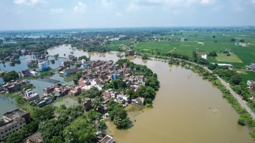
CM Samrat Choudhary personally conducted an aerial survey of elevated water levels in Champaran , North Bihar.
District administration has been directed to stay alert and ready on relief, rescue, and essential arrangements in flood-affected areas.
Champaran — covering East and West Champaran districts — is recurrently impacted by rivers originating in Nepal that overflow during the monsoon season.
The aerial survey is part of established Bihar state disaster management protocols activated each monsoon.
The Chief Minister's direct assessment is expected to accelerate resource deployment and sharpen accountability at the district level.
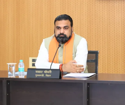
With rising waters swallowing swathes of Champaran in North Bihar, Bihar Chief Minister Samrat Choudhary took to the skies to personally assess the scale of the flood crisis — and came back with direct orders for the administration on the ground.
Posting on X, CM Choudhary confirmed he conducted an aerial survey of the elevated water levels in Champaran, stating: 'चंपारण में बढ़े हुए जलस्तर का हवाई सर्वेक्षण कर स्थिति का जायजा लिया' ('Conducted an aerial survey of the rising water levels in Champaran to assess the situation'). He added that district officials have been instructed to remain alert and ready on relief, rescue, and essential arrangements in flood-affected areas.
Champaran's recurring battle with floodwaters
East and West Champaran districts sit in the arc of North Bihar most exposed to rivers that originate in Nepal and swell dramatically during the monsoon. The region has faced this cycle for decades — rivers overflow, low-lying villages go under, and the state machinery mobilises. An aerial survey by the Chief Minister is a standard but significant step: it gives the top executive a direct, unfiltered read of how far the inundation has spread, cutting through the lag of ground-level reporting.
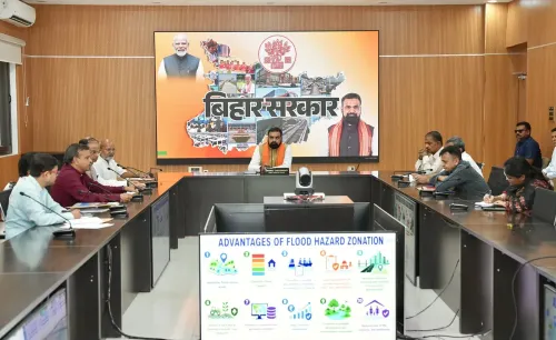
Bihar's flood management framework places the Chief Minister at the apex of disaster response coordination, with district magistrates and block-level officials executing relief and rescue on the ground. The instruction to remain 'सतर्क एवं तत्पर' ('alert and ready') signals that the administration has been placed on active standby — not a routine advisory, but a direct command following a first-hand aerial assessment.
What the administration has been told to do
The Chief Minister's directives, as stated in the post, cover three pillars: relief (food, shelter, essentials for displaced residents), rescue (evacuation of those stranded by rising water), and necessary arrangements (logistics, medical support, communication). These align with established state disaster management protocols that Bihar activates each monsoon season.
For the thousands of residents in flood-affected pockets of Champaran, the aerial visit by the Chief Minister matters beyond optics — it typically accelerates resource deployment and sharpens administrative accountability. The districts will now be watched closely for how quickly relief reaches those cut off by the waters.
The monsoon clock is ticking, and CM Choudhary has made clear: the state is watching from above, and the orders are already on the ground.
Point of View
Which matters in a state where annual flooding is an electoral flashpoint. For Samrat Choudhary, personally overseeing the Champaran situation reinforces his hands-on image in a region that carries deep historical and political resonance for Bihar. The directive to keep the administration 'alert and ready' also creates a clear accountability trail: if relief falters, the command from the top is on record. Bihar's flood management has long been criticised for the gap between high-level orders and ground-level delivery — how quickly that gap closes in Champaran will be the real test.
NationPress
30 Sept 2026
Frequently Asked Questions
Why did Bihar CM Samrat Choudhary conduct an aerial survey of Champaran?
Bihar CM Samrat Choudhary conducted an aerial survey to personally assess the extent of rising floodwaters in Champaran and to direct the district administration on relief, rescue, and essential arrangements for affected residents.
Which districts are affected by flooding in Champaran, Bihar?
Champaran refers to the North Bihar region covering East Champaran and West Champaran districts, both of which are recurrently impacted by rivers originating in Nepal that overflow during the monsoon season.
What instructions did CM Samrat Choudhary give after the aerial survey?
After the aerial survey, CM Choudhary directed the district administration to remain alert and ready, focusing on three areas: relief distribution, rescue operations, and ensuring all necessary arrangements for flood-affected communities.
Why does Bihar face floods every year in Champaran?
Bihar's northern districts, including Champaran, are highly vulnerable to annual flooding because major rivers flowing through the region originate in Nepal and carry heavy monsoon discharge, regularly breaching banks and inundating low-lying areas.
What is Bihar's standard response to monsoon flooding?
Bihar activates established state disaster management protocols each monsoon, including aerial surveys by senior officials, deployment of rescue teams, relief distribution, and coordination between the Chief Minister's office and district-level administrators.