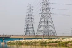
CM Samrat Choudhary Conducts Aerial Survey of West Champaran Floods

Synopsis
Bihar Chief Minister Samrat Choudhary took to the skies on September 30 to survey worsening flood conditions in West Champaran, ordering district officials to mobilise relief, rescue, and essential services without delay in the affected areas.
Key Takeaways
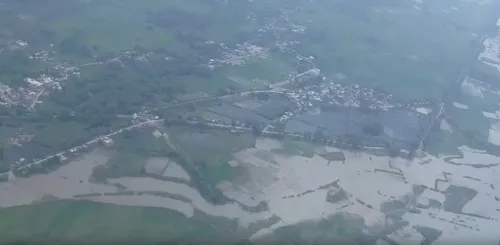
Chief Minister Samrat Choudhary conducted an aerial survey of rising water levels in West Champaran on September 30, 2026 .
He directed the district administration to remain alert and prompt in carrying out flood relief, rescue, and essential arrangements.
West Champaran borders Nepal and faces annual flooding from transboundary rivers including the Gandak .
The survey follows a pattern of aerial assessments Bihar administrations have conducted during monsoon flood emergencies in past years.
Key concerns going forward include relief camp operations, embankment monitoring, and potential requests for central government disaster assistance.
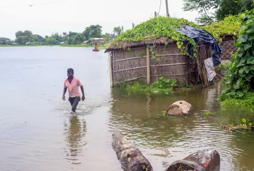
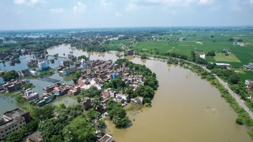
From the air, the scale of Bihar's flood crisis becomes impossible to ignore. Chief Minister Samrat Choudhary conducted an aerial survey of rising water levels in West Champaran on Wednesday, September 30, 2026, personally assessing the extent of inundation and directing the district administration to remain on high alert for relief and rescue operations.
What the CM Saw Over West Champaran
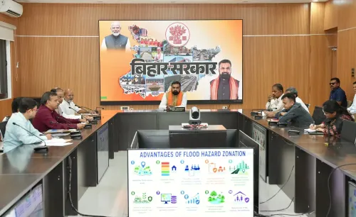
The Chief Minister's Office of Bihar confirmed that Choudhary surveyed flood-affected zones from the air, getting a firsthand view of the waterlogged landscape across West Champaran — a district that hugs the Nepal border and is perennially in the crosshairs of monsoon flooding. Following the survey, he issued instructions to local officials to ensure that relief camps, rescue teams, and essential supplies are fully mobilised and ready.
The post, in Hindi, noted that he directed the administration 'sateek evam tatpar rehne' — 'to remain alert and prompt' — in handling flood relief, rescue, and necessary arrangements in affected areas.
Why West Champaran Floods Every Year
West Champaran's vulnerability is structural. The district sits at the foot of the Himalayan foothills and receives the surge of transboundary rivers — including the Gandak — that swell with Nepali catchment rainfall every monsoon season. There is no quick fix: the topography and the cross-border river dynamics mean flooding is a near-annual certainty, not an exception.
Successive Bihar governments have responded in broadly similar fashion — aerial surveys, administrative alerts, rescue deployments — but the recurrence of the crisis underlines the limits of reactive governance in a zone that needs deeper structural investment in embankment management and early-warning infrastructure.
What the Administration Must Now Deliver
The immediate operational burden falls on West Champaran's district machinery: running relief camps for displaced residents, monitoring embankment integrity, and ensuring boats and medical teams are positioned ahead of any further rise in water levels. With the CM's direct observation on record, the pressure on local officials to perform is now public and explicit.
Whether the state escalates to seek central government disaster assistance will depend on how the next few days unfold — particularly any further swell in river levels as late-monsoon rainfall continues across the Nepal watershed.
Point of View
Where flood-season governance is graded annually by voters in the Terai belt, the optics of a hands-on CM matter. Yet the deeper question the survey cannot answer is whether Bihar's response architecture is shifting from reactive crisis management toward durable structural investment in embankments and cross-border river-management diplomacy with Nepal — an area where progress has been slow across successive governments.
NationPress
30 Sept 2026
Frequently Asked Questions
Why is West Champaran prone to flooding every year?
West Champaran sits along Bihar's Nepal border and receives overflow from transboundary rivers like the Gandak, which swell with heavy Himalayan catchment rainfall each monsoon season, making the district one of Bihar's most flood-vulnerable zones.
What did Bihar CM Samrat Choudhary do during the West Champaran flood survey?
CM Samrat Choudhary conducted an aerial survey of the rising water levels in West Champaran on September 30, 2026, and instructed the district administration to stay on high alert for relief, rescue, and essential service deployment in flood-affected areas.
What relief measures are being taken for West Champaran flood victims?
The CM directed the administration to ensure all relief, rescue, and necessary arrangements are in place. Specific measures include running relief camps, positioning rescue teams, and monitoring embankments, though detailed camp numbers were not specified in the official update.
Can the central government provide assistance for Bihar floods?
Yes, Bihar can request central government assistance under the National Disaster Response Fund (NDRF) framework. Whether a formal request will be made depends on how the flood situation in West Champaran and other affected districts develops in the coming days.
Which rivers cause flooding in West Champaran, Bihar?
The Gandak is among the primary rivers that causes recurrent flooding in West Champaran. Fed by Himalayan snowmelt and Nepali monsoon rainfall, it regularly breaches its banks and inundates low-lying areas of the district during the monsoon season.