CM Hemant Soren Orders GIS Urban Roll-Out Across Jharkhand

Synopsis
Chief Minister Hemant Soren has reviewed a GIS-based urban management system covering 49 urban local bodies in Jharkhand and ordered its phased statewide rollout. Aerial LiDAR surveys under the pilot project are complete in Ranchi, Dhanbad, and Giridih, marking a significant step in data-driven urban governance for the state.
Key Takeaways
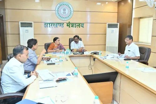
Chief Minister Hemant Soren reviewed a GIS-based urban management system covering 49 urban local bodies in Jharkhand on 24 June 2026 .
Aerial LiDAR surveys under the pilot project have been completed in Ranchi , Dhanbad , and Giridih .
CM Soren directed the system to be implemented across the entire state in a phased manner .
The initiative aligns with national programmes including the Smart Cities Mission , AMRUT , and Digital India .
States such as Telangana , Karnataka , and Madhya Pradesh have deployed similar geospatial tools for urban governance.
Potential integration with AMRUT 2.0 and the SVAMITVA scheme is being watched by policy observers.
The Chief Minister's Office of Jharkhand announced on Wednesday, 24 June 2026 that Chief Minister Hemant Soren has reviewed the GIS-based urban management system across 49 urban local bodies in the state and directed its phased implementation statewide. Aerial LiDAR surveys under the pilot project have been completed in Ranchi, Dhanbad, and Giridih.
Context
The post from the official Jharkhand CMO account states: 'पायलट प्रोजेक्ट के तहत रांची, धनबाद और गिरिडीह में हवाई LiDAR सर्वेक्षण का काम पूरा हो चुका है' — 'Under the pilot project, aerial LiDAR survey work in Ranchi, Dhanbad and Giridih has been completed.' Chief Minister Soren has now issued directions to roll out the system in a phased manner across the entire state. The review covered all 49 urban local bodies currently under the GIS urban management framework.
LiDAR — Light Detection and Ranging — is an aerial remote-sensing technology that generates high-resolution three-dimensional maps of urban terrain, buildings, and infrastructure. When integrated with GIS platforms, it enables municipalities to manage property records, plan infrastructure, and deliver civic services with greater precision.
Policy Backdrop
Jharkhand's initiative aligns with a broader national push toward data-driven urban governance. India's Smart Cities Mission, launched in 2015, has promoted GIS and digital mapping technologies across selected cities. The AMRUT (Atal Mission for Rejuvenation and Urban Transformation) programme and the Digital India initiative have similarly encouraged states to adopt geospatial tools for municipal service delivery and infrastructure planning.
Several states including Telangana, Karnataka, and Madhya Pradesh have deployed comparable GIS and LiDAR systems for property tax administration, urban planning, and disaster risk management. Jharkhand's pilot-to-statewide rollout follows this established pattern of scaling proven geospatial tools across urban administrations.
Stakeholders and Impact
The primary beneficiaries of the expanded system will be the 49 urban local bodies and their municipal officials, who will gain access to accurate, real-time spatial data for governance decisions. Residents of urban areas across Jharkhand stand to benefit from improved property record management, more efficient infrastructure planning, and better delivery of civic amenities.
Ranchi, the state capital, Dhanbad, a major industrial and mining hub, and Giridih served as the three pilot cities where the aerial survey phase has been completed. The data gathered from these cities is expected to form the template for the statewide deployment that CM Soren has now ordered.
What's Next
With the pilot phase concluded in three cities, the focus now shifts to the phased expansion of the GIS-based urban management system to the remaining urban local bodies across Jharkhand. Observers will watch whether the rollout is integrated with central programmes such as AMRUT 2.0 or the SVAMITVA scheme, which maps property rights in rural and peri-urban areas. The pace and resourcing of the statewide expansion will determine how quickly Jharkhand's urban bodies can operationalise the new system for day-to-day governance.
Point of View
The directive carries political utility — it signals administrative modernisation ahead of continued scrutiny over urban service delivery in a rapidly urbanising state. The pilot-first, scale-later approach mirrors the methodology endorsed under central missions, suggesting Jharkhand is positioning itself to leverage additional federal funding tied to digital urban infrastructure. The real test will be implementation speed and whether the spatial data generated translates into measurable improvements in property tax collection, infrastructure planning, and civic service efficiency.
NationPress
24 Jun 2026
Frequently Asked Questions
What is the GIS-based urban management system in Jharkhand?
It is a Geographic Information System platform being deployed across Jharkhand's 49 urban local bodies to improve urban planning, property records, and civic service delivery using aerial LiDAR survey data.
Which cities completed the LiDAR survey pilot in Jharkhand?
Aerial LiDAR surveys under the pilot project have been completed in Ranchi, Dhanbad, and Giridih.
What did CM Hemant Soren order regarding the GIS system?
CM Hemant Soren directed that the GIS-based urban management system be implemented across the entire state of Jharkhand in a phased manner.
What is LiDAR and why is it used for urban management?
LiDAR stands for Light Detection and Ranging — an aerial remote-sensing technology that creates high-resolution 3D maps of urban areas, enabling municipalities to manage infrastructure, property records, and civic services more accurately.
How does Jharkhand's GIS initiative connect to national schemes?
The initiative aligns with India's Smart Cities Mission, AMRUT, and Digital India programmes, which encourage states to adopt geospatial and digital tools for urban governance.