CM Himanta Speeds Up Assam Flood Embankment Push
Synopsis
Assam Chief Minister Himanta Biswa Sarma has announced an accelerated push to expand the state's flood embankment network using geo mega tube technology, backed by round-the-clock monitoring, as the 2026 monsoon season intensifies along the Brahmaputra valley.
Key Takeaways
Assam CM Himanta Biswa Sarma announced on 3 July 2026 that the state is accelerating its flood resilience efforts.
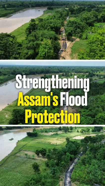
The expansion of the embankment network will use geo mega tube technology , a geotextile-based solution that resists erosion and seepage better than traditional earthen bunds.
Round-the-clock monitoring of embankments has been deployed alongside the structural upgrades to enable early response to flood stress.
Assam has relied on embankments as its primary flood defence since the 1950s ; the Brahmaputra's high discharge and siltation make the state one of India's most flood-vulnerable.
The initiative aligns with the central government's Flood Management Programme , launched in 2007 to fund embankment construction and strengthening across states.
Specific locations, scale, and completion timelines for the geo mega tube expansion have not yet been officially disclosed.
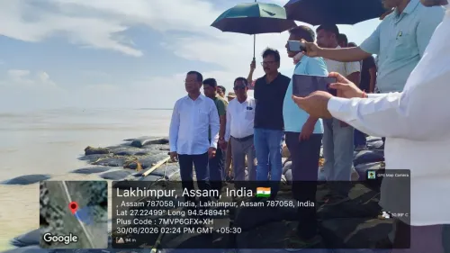
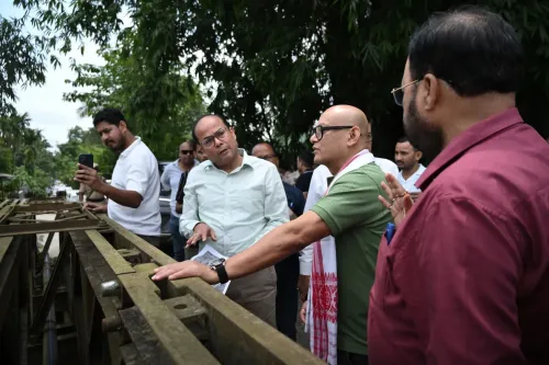
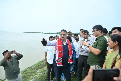
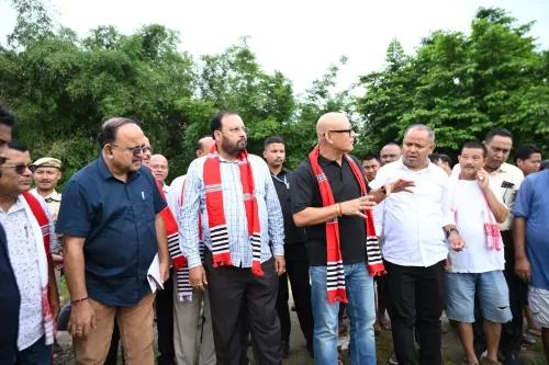
Assam Chief Minister Himanta Biswa Sarma announced on Friday, 3 July 2026 that the state is accelerating its flood resilience drive by expanding its embankment network using geo mega tube technology and maintaining round-the-clock monitoring of vulnerable stretches.
Context
Assam is one of India's most flood-prone states, traversed by the Brahmaputra river system — a vast, high-discharge waterway whose annual monsoon surge inundates farmland, displaces communities, and erodes riverbanks across the Assam valley. The state has historically relied on earthen embankments as its primary structural defence, a network built up since the 1950s and periodically upgraded following major flood events. CM Sarma's post signals a fresh push to modernise that infrastructure ahead of the peak 2026 monsoon season.
Geo mega tube technology refers to large geotextile-fabric tubes filled with hydraulic fill or sand slurry, deployed along riverbanks and embankment faces to resist erosion, reduce seepage, and withstand high water pressure — limitations that have historically caused traditional earthen bunds to breach during peak discharge events. State governments across the Northeast have increasingly piloted geotextile-based solutions to address these structural vulnerabilities.
Policy Backdrop
The Government of India launched the Flood Management Programme (FMP) in 2007 to provide central assistance to states for the construction and strengthening of embankments and allied flood-control works. Assam has been a significant beneficiary of this programme, given the scale and frequency of inundation along the Brahmaputra and its tributaries. The current state-level push to incorporate geo mega tube technology fits within the broader FMP framework of upgrading design standards for flood infrastructure.
Broader regional trends also point to a shift in approach: the Northeast's high sediment loads, climate-influenced rainfall variability, and the Brahmaputra's notorious channel migration have repeatedly exposed the limits of conventional earthen embankments. Geotextile-reinforced structures offer longer service life and greater resistance to the dynamic hydraulic conditions typical of the region's rivers.
Stakeholders and Impact
The communities most directly affected are those living along the Brahmaputra and its distributaries — smallholder farmers who lose crops to inundation, households displaced by bank erosion, and local administrations that bear the annual cost of flood relief and rehabilitation. Faster embankment expansion with more durable geo mega tube reinforcement, if implemented at scale, could reduce the frequency and severity of breaches that have historically caused the most acute damage.
Round-the-clock monitoring — whether through sensor networks, patrol teams, or digital surveillance — adds an early-warning dimension to the structural upgrades, allowing authorities to respond to rising water levels or embankment stress before a breach occurs. This operational layer is as important as the physical infrastructure in limiting flood casualties and economic losses.
What's Next
Observers will watch for the release of project-level details — including the specific stretches targeted, the volume of geo mega tube deployment, and the funding breakdown between state and central sources — as the 2026 monsoon progresses. Any new sanctions under the central Flood Management Programme during this season will be a key indicator of how much central support backs the state's accelerated ambition. The Assam government's next budget or flood-management action plan is expected to shed further light on the scale and timeline of these infrastructure commitments.
If the geo mega tube embankment expansion delivers measurable reductions in breach incidents this monsoon, it could serve as a replicable model for other flood-prone states in the Northeast and beyond — putting Assam at the forefront of geotextile-based flood resilience in India.
Point of View
Technology-enabled infrastructure. By publicly flagging geo mega tube deployment and 24/7 monitoring, the BJP-led state government is positioning itself as a moderniser on an issue that has historically defined electoral sentiment in the Brahmaputra valley. The timing, at the onset of the peak monsoon season, is deliberate: it signals administrative readiness to a constituency that has endured annual inundation for decades. Whether the accelerated rollout translates into measurable reductions in breach incidents will determine how durable this political and policy dividend proves to be.
NationPress
3 Jul 2026
Frequently Asked Questions
What is geo mega tube technology used in Assam floods?
Geo mega tube technology involves large geotextile-fabric tubes filled with sand slurry or hydraulic fill, deployed along riverbanks and embankments to resist erosion, prevent seepage, and withstand high water pressure — making them more durable than conventional earthen bunds in high-discharge river systems like the Brahmaputra.
Why does Assam flood every year?
Assam floods annually because the Brahmaputra river carries extremely high water discharge during the monsoon season, compounded by heavy siltation, bank erosion, and channel migration. The state's low-lying valley geography makes it one of India's most flood-vulnerable regions.
What is the Flood Management Programme in India?
The Flood Management Programme is a central government scheme launched in 2007 to provide financial assistance to states for constructing and strengthening embankments, drainage channels, and other flood-control infrastructure. Assam is one of its major beneficiaries.
What has Himanta Biswa Sarma done about Assam floods?
CM Himanta Biswa Sarma has announced an accelerated expansion of Assam's embankment network using geo mega tube technology, alongside round-the-clock monitoring of flood-vulnerable stretches, as part of the state's broader flood resilience strategy during the 2026 monsoon season.
How does round-the-clock embankment monitoring help during floods?
Continuous monitoring of embankments allows authorities to detect rising water levels or structural stress early, enabling rapid response before a breach occurs. This early-warning capability can significantly reduce the damage to crops, property, and lives in flood-prone areas.