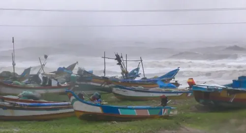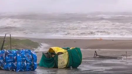


Cyclone Akvan likely to weaken before landfall on Andhra-Odisha coast Friday
Synopsis
Cyclone Akvan is set to cross the North Andhra–South Odisha coast on Friday noon, but authorities now expect the storm to weaken before landfall. With 13 NDRF and 11 SDRF teams on standby and North Coastal districts on high alert, the state machinery is fully mobilised — even as the worst-case scenario appears to be receding.
Key Takeaways
Severe cyclonic storm Akvan is likely to weaken before crossing the North Andhra Pradesh–South Odisha coast around noon on 20 November 2026 .
IMD projects landfall between Narsapur and Puri , with wind speeds of 90–100 kmph gusting to 110 kmph .
North Andhra Pradesh will bear the primary impact; Central and South Andhra Pradesh face minimal effect.
13 NDRF and 11 SDRF teams deployed on standby; control centres operating 24/7 .
Coastal districts of Srikakulam , Vizianagaram , Visakhapatnam , Kakinada , and Godavari on high alert for 24–36 hours .
Fishermen advised not to venture into the sea; residents in low-lying areas urged to follow official advisories.
Severe cyclonic storm Akvan is expected to weaken before making landfall along the North Andhra Pradesh and South Odisha coasts around noon on Friday, 20 November, according to the India Meteorological Department (IMD). The storm's primary impact is now anticipated to be confined to North Andhra Pradesh, with Central and South Andhra Pradesh expected to see little significant effect.
Storm Position and Track
As per the IMD bulletin issued on Thursday morning, the severe cyclonic storm was positioned over the west-central Bay of Bengal, moving northward at 12 kmph. At 0530 hours, the system lay centred approximately 440 km east-southeast of Narsapur (Andhra Pradesh), 440 km south-southeast of Kalingapatnam (Andhra Pradesh), 580 km east-northeast of Chennai (Tamil Nadu), 530 km south of Gopalpur (Odisha), and 590 km south of Puri (Odisha).
The IMD projects the storm will move north-northwestward and cross between Narsapur and Puri, close to the east of Gopalpur, with maximum sustained wind speeds of 90–100 kmph gusting to 110 kmph at landfall.
Expected Weakening Before Landfall
The Andhra Pradesh State Disaster Management Authority (APSDMA) said the system is expected to weaken before it crosses the coast, based on the latest meteorological guidance. Rainfall is forecast to reduce quickly after landfall. Widespread moderate to heavy rainfall, with isolated very heavy spells, is expected across North Andhra Pradesh districts on Thursday, followed by lighter, isolated moderate rainfall across North Coastal districts.
The coastal districts of Srikakulam, Vizianagaram, Visakhapatnam, Kakinada, and the Godavari districts have been placed on high alert for the next 24–36 hours, according to the APSDMA advisory.
Government Preparedness and Relief Measures
Andhra Pradesh Home Minister V. Anitha chaired a review meeting with senior officials to assess the cyclone's potential impact and oversee precautionary measures. She directed all state departments to remain on full alert for the next 48 hours, with explicit instructions to take proactive steps to prevent loss of life and property.
The minister confirmed that 13 National Disaster Response Force (NDRF) teams and 11 State Disaster Response Force (SDRF) teams, along with local fire service units, have been placed on standby. Relief teams are ready for immediate deployment to affected areas as required.
Advisories for Residents and Fishermen
The APSDMA has advised fishermen to refrain from venturing into the sea until further notice. Residents in low-lying and coastal areas have been urged to stay alert and strictly follow official advisories. District administrations are actively monitoring tanks, vulnerable mandals, and coastal zones. Control centres at district and mandal headquarters have been directed to operate round-the-clock and respond promptly to public requests for assistance.
Authorities will continue monitoring the system's intensity as it approaches the coastline, with the situation likely to become clearer by Thursday evening.
Point of View
But the state's response framework is worth noting: North Andhra's coastal districts face recurring cyclone exposure each season, and the speed with which NDRF teams were pre-positioned reflects hard lessons from past storms. The critical variable now is not wind speed but rainfall intensity in already-saturated river delta zones — the Godavari basin in particular. Flood risk from accumulated discharge often outlasts the storm itself, and that is where the real post-landfall test for district administrations lies.
NationPress
19 Nov 2026
Frequently Asked Questions
When and where is Cyclone Akvan expected to make landfall?
Cyclone Akvan is expected to cross the North Andhra Pradesh and South Odisha coasts between Narsapur and Puri, close to the east of Gopalpur, around noon on Friday, 20 November 2026. The IMD projects maximum sustained wind speeds of 90–100 kmph gusting to 110 kmph at landfall.
Will Cyclone Akvan weaken before it hits the coast?
Yes, according to the Andhra Pradesh State Disaster Management Authority, the system is expected to weaken before making landfall, based on the latest meteorological guidance. Rainfall is also forecast to reduce quickly after the storm crosses the coast.
Which districts in Andhra Pradesh are on high alert?
The North Coastal districts of Srikakulam, Vizianagaram, Visakhapatnam, Kakinada, and Godavari districts have been placed on high alert for the next 24–36 hours. Central and South Andhra Pradesh are not expected to see significant impact from the storm.
What disaster response resources have been deployed for Cyclone Akvan?
Andhra Pradesh Home Minister V. Anitha confirmed that 13 NDRF teams, 11 SDRF teams, and local fire service units have been placed on standby. District- and mandal-level control centres are operating round-the-clock to coordinate relief efforts.
What should residents and fishermen do ahead of Cyclone Akvan's landfall?
Fishermen have been advised not to venture into the sea until further notice. Residents in low-lying and coastal areas should stay alert and strictly follow official advisories issued by the APSDMA and district administrations.