

Cyclone Murasu batters coastal Andhra: heavy rains, no casualties reported
Synopsis
Cyclone Murasu made landfall on Andhra Pradesh's south coast before dawn on Tuesday with winds gusting to 120 kmph — yet the headline is what didn't happen: zero casualties. The storm is also narrowing a severe rainfall deficit from 53% to under 29%, turning a natural disaster partly into a water-security relief, even as heavy rains are set to continue through Wednesday.
Key Takeaways
Cyclone Murasu crossed the south Andhra Pradesh coast between Nellore and Narasapur between 3:30 am and 5:30 am on 3 November 2026 .
Wind speeds at landfall reached 100–110 kmph , gusting to 120 kmph ; no casualties have been reported.
IMD warns of extremely heavy rainfall in coastal Andhra Pradesh, Yanam, and Telangana on Tuesday; the storm is expected to weaken to a deep depression by Tuesday midnight .
Chandrababu Naidu monitored the situation from the RTGS Centre in Amaravati, coordinating with Tamil Nadu and Karnataka counterparts for restoration.
The state's rainfall deficit dropped from 53% to 28.9% due to cyclones Arnab and Murasu; groundwater rose by 0.45 metres in a single day.
Reservoirs received 7–8 TMC of water; overall groundwater recharge estimated at 20–30 TMC .
Severe cyclonic storm Murasu crossed the south Andhra Pradesh coast between Nellore and Narasapur in the early hours of Tuesday, 3 November 2026, bringing heavy rains, gusty winds, and widespread disruption to coastal districts. Wind speeds at landfall were recorded at 100–110 kmph, gusting up to 120 kmph. No loss of life has been reported so far.
Where the Storm Hit Hardest
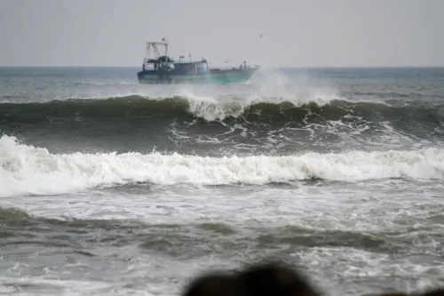
Widespread rainfall was recorded across Prakasam, Bapatla, Palnadu, Krishna, Eluru, and West Godavari districts. Since Monday, the state logged an average rainfall of 20.38 cm, with Bapatla receiving 21 cm and Prakasam receiving 20 cm. Sea conditions off the Bapatla coast turned rough, with high waves pushing seawater approximately 50 metres inland at Suryalanka beach.
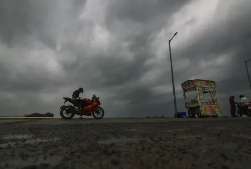
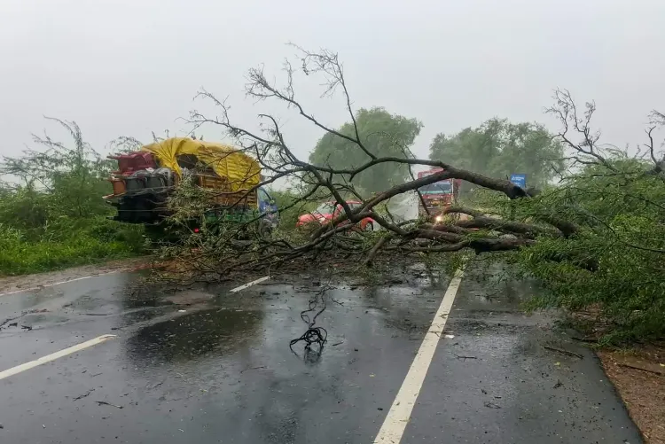
Gusty winds uprooted trees and electricity poles in several locations, while heavy rains inundated low-lying areas, disrupting normal life. Crops were damaged, and power supply was cut in the worst-affected districts.
IMD Alert and Weather Outlook
The India Meteorological Department (IMD) indicated that Murasu is likely to move north-northwestwards and gradually weaken into a deep depression by Tuesday midnight. It warned of extremely heavy rainfall in coastal Andhra Pradesh, Yanam, and adjoining Telangana on Tuesday, with very heavy rainfall continuing in coastal Andhra Pradesh and Yanam on Wednesday.
The Andhra Pradesh State Disaster Management Authority (APSDMA) said heavy rains are likely in Polavaram, Kakinada, NTR, Krishna, Bapatla, and Palnadu districts in the near term, with moderate rainfall expected in Manyam, East Godavari, West Godavari, Konaseema, and Eluru. Heavy rains in Bapatla, Guntur, and Prakasam are expected to continue until Wednesday morning.
Chief Minister Chandrababu Naidu Reviews Situation
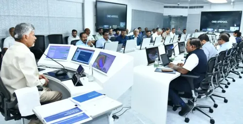
Chief Minister N. Chandrababu Naidu monitored the cyclone's impact from the Real-Time Governance Society (RTGS) Centre at the Secretariat in Amaravati. He reviewed rainfall data across districts, wind intensity reports, and the overall administrative response.
Naidu credited sustained public alerts for preventing casualties, stating that precious lives were saved by keeping the public alerted at all times. He also said he reached out to the Chief Ministers of Tamil Nadu and Karnataka to seek cooperation in restoration efforts.
The Chief Minister directed officials to ensure data-driven decision-making and maintain effective administrative systems throughout the emergency. Notably, this is not the first cyclone to test Andhra Pradesh's disaster management this season — Murasu follows cyclone 'Arnab', which also brought significant rainfall to the region earlier.
Silver Lining: Rainfall Deficit and Groundwater Levels Improve
Despite the disruption, officials noted a measurable benefit: the state's average rainfall deficit fell from 53 per cent to 28.9 per cent, attributed to rains from both cyclones Arnab and Murasu. A further 2 per cent reduction is expected over the next five days.
Groundwater levels rose by 0.45 metres in a single day, with groundwater reserves estimated to recharge by 20–30 TMC (thousand million cubic feet). Ponds and minor irrigation tanks received up to 10 TMC of water, while reservoirs have seen an inflow of 7–8 TMC.
Residents in affected areas have been advised to remain alert and follow official weather updates. With Murasu still expected to bring heavy rainfall through Wednesday, authorities are maintaining a heightened state of readiness.
Point of View
RTGS-led real-time governance, and pre-emptive evacuation protocols that the state pioneered after catastrophic losses in earlier storms. What mainstream coverage misses is the rainfall-deficit angle: two back-to-back cyclones have done more for Andhra's groundwater table in days than months of normal monsoon. The real test now is whether restoration pace in damaged agricultural districts matches the speed of the weather response — crop losses in delta districts could hurt Rabi sowing timelines significantly.
NationPress
3 Nov 2026
Frequently Asked Questions
Where did Cyclone Murasu make landfall in Andhra Pradesh?
Cyclone Murasu crossed the south Andhra Pradesh coast between Nellore and Narasapur between 3:30 am and 5:30 am on Tuesday, 3 November 2026. Wind speeds at landfall were 100–110 kmph, gusting to 120 kmph.
Are there any casualties due to Cyclone Murasu?
No loss of life has been reported so far from Cyclone Murasu. Chief Minister N. Chandrababu Naidu credited continuous public alerts for saving lives, adding that the administration had kept citizens informed throughout.
Which districts are most affected by Cyclone Murasu?
Bapatla, Prakasam, Guntur, Krishna, Eluru, and West Godavari are the worst-affected districts. The APSDMA has also flagged Polavaram, Kakinada, NTR, and Palnadu for imminent heavy rainfall in the coming hours.
When will Cyclone Murasu weaken?
The IMD has forecast that Murasu will move north-northwestwards and gradually weaken into a deep depression by Tuesday midnight, 3 November 2026. Very heavy rainfall is still expected in coastal Andhra Pradesh and Yanam on Wednesday.
Has Cyclone Murasu had any positive impact on water levels in Andhra Pradesh?
Yes, rainfall from Murasu and the preceding Cyclone Arnab has reduced the state's rainfall deficit from 53% to 28.9%. Groundwater levels rose by 0.45 metres in a single day, with an estimated recharge of 20–30 TMC expected over the coming days.