

IIT Madras SEANAV: Real-time digital twin platform for autonomous maritime navigation
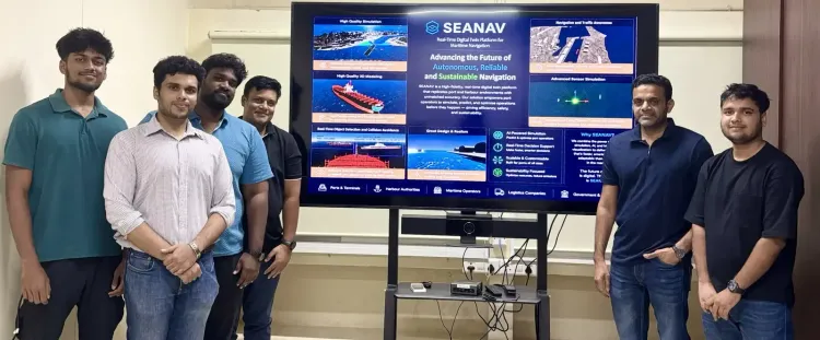
Synopsis
IIT Madras has built SEANAV — a Unity-powered digital twin that lets autonomous ships rehearse collision avoidance, path-following, and adverse-weather navigation in a virtual ocean before hitting real waters. Combined with the custom 14,000-image DetectShips dataset and the LiDAR-stereo-camera StereoLiD framework, it is one of the most comprehensive autonomous maritime safety platforms to emerge from Indian academia.
Key Takeaways
IIT Madras researchers have developed SEANAV , a real-time digital twin platform for testing and training autonomous maritime navigation systems.
The platform integrates AI , VR , and multi-sensor fusion on a Unity-based simulation engine , recreating waves, traffic, and adverse weather.
The team created 'DetectShips' , a custom dataset of 14,000 real ship images , to address gaps in existing maritime vision datasets. 'StereoLiD' , a hybrid sensing framework combining stereo cameras and LiDAR , uses a Kalman filter for precise vessel localisation.
The research has been published in the Journal of Offshore Mechanics and Arctic Engineering (ASME) and presented at ASME OMAE conferences in Vancouver and Tokyo .
Researchers at the Department of Ocean Engineering, Indian Institute of Technology (IIT) Madras, have developed SEANAV, a real-time digital twin platform engineered to test, validate, and train autonomous maritime navigation systems, enabling vessels to navigate more safely across complex ocean environments. The development, published in the Journal of Offshore Mechanics and Arctic Engineering (ASME), represents a significant step forward for AI-driven shipping safety.
What SEANAV Does
SEANAV integrates Artificial Intelligence (AI), Virtual Reality (VR), and multi-sensor fusion to construct a detailed virtual ocean environment built on a Unity-based simulation engine. The platform recreates realistic ocean waves, dynamic shipping traffic, and adverse weather conditions, allowing autonomous vessels to execute AI-driven collision avoidance and path-following manoeuvres before they ever set sail. Multiple ships can navigate congested virtual waterways simultaneously, and the system also provides an immersive VR interface for training maritime professionals.
According to the research team, conducting thousands of hours of virtual simulation substantially reduces testing costs while promoting safer and more sustainable shipping operations — a compelling case for the platform's commercial and regulatory relevance.
Bridging Gaps in Maritime Vision Datasets
A key challenge the team addressed was the inadequacy of existing maritime vision datasets. Widely used resources such as SeaShips and HRSC2016, researchers noted, lack sufficient variation in viewpoints and weather conditions, which limits the real-world reliability of deep learning models designed for maritime navigation. To overcome this gap, the team developed a novel custom dataset called 'DetectShips', comprising 14,000 real ship images, and combined it with the SeaShips dataset to train a computer vision algorithm integrated with stereo sensors.
StereoLiD: A Hybrid Sensing Framework
Beyond the dataset, the researchers introduced 'StereoLiD', a hybrid sensing framework that fuses stereo vision cameras with LiDAR data sourced from the Unity simulation platform. In this architecture, stereo cameras detect and classify vessels to estimate relative depth, while LiDAR inputs further refine depth estimation accuracy. Data from both sensors are then fused using a Kalman filter, achieving precise target localisation even in challenging conditions.
According to the researchers, this multi-vision sensor fusion approach overcomes common limitations of conventional optical sensors — including fluctuating lighting and dense fog — ensuring dependable target detection and navigation across complex oceanic environments.
Academic Recognition and Global Reach
The research has not only been published in a peer-reviewed ASME journal but was also presented at ASME OMAE conferences in Vancouver and Tokyo, signalling international validation of the platform's scientific merit. The dual recognition underscores IIT Madras's growing profile in ocean engineering research with real-world applications for global shipping.
What Comes Next
As autonomous vessels inch closer to commercial deployment worldwide, platforms like SEANAV could become essential infrastructure for regulatory certification and crew training. The integration of increasingly sophisticated AI with simulation-based safety frameworks is widely seen as a prerequisite for the maritime industry's autonomous future, and IIT Madras's contribution positions India as a credible player in that transition.
Point of View
Making this IIT Madras output a rare instance of homegrown research with genuine international market relevance. The unresolved question is whether industry adoption will follow academic validation — a gap Indian R&D has historically struggled to close.
NationPress
13 Nov 2026
Frequently Asked Questions
What is SEANAV developed by IIT Madras?
SEANAV is a real-time digital twin platform developed by researchers at IIT Madras's Department of Ocean Engineering to test, validate, and train autonomous maritime navigation systems. It uses AI, VR, and multi-sensor fusion on a Unity-based simulation engine to recreate realistic ocean environments, allowing ships to practise collision avoidance and path-following before deployment.
What is the DetectShips dataset and why was it developed?
DetectShips is a custom dataset of 14,000 real ship images created by the IIT Madras team to address limitations in existing maritime vision datasets like SeaShips and HRSC2016, which lack sufficient variation in viewpoints and weather conditions. It was combined with SeaShips to train a computer vision algorithm integrated with stereo sensors for more reliable deep learning performance.
What is StereoLiD and how does it work?
StereoLiD is a hybrid sensing framework developed as part of the SEANAV platform that combines stereo vision cameras with LiDAR data. Stereo cameras detect and classify vessels and estimate relative depth, while LiDAR refines depth accuracy; data from both sensors are fused using a Kalman filter to achieve precise target localisation even in low-visibility conditions like dense fog.
Where has the SEANAV research been published and presented?
The research has been published in the Journal of Offshore Mechanics and Arctic Engineering (ASME) and was presented at ASME OMAE international conferences held in Vancouver and Tokyo, reflecting broad academic and international recognition.
Why does SEANAV matter for the future of shipping?
As autonomous vessels approach commercial deployment globally, simulation-based platforms like SEANAV could serve as essential infrastructure for regulatory certification, crew training, and safety validation. By enabling thousands of hours of virtual testing, the platform aims to cut costs and improve safety before autonomous ships navigate real waters.