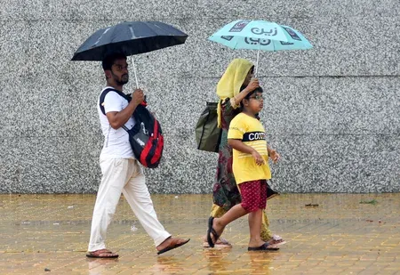
Heavy rain warning for West Bengal from Tuesday as Bay of Bengal low-pressure forms

Synopsis
A developing low-pressure area in the Bay of Bengal is set to intensify into a deep depression by Tuesday, bringing sustained heavy rainfall to south Bengal districts from Tuesday through Saturday. With wind speeds forecast to hit 70 km/h near the central Bay and fishermen barred from sea until Friday, the system poses a significant coastal and agricultural risk across the region.
Key Takeaways
The Regional Meteorological Centre (RMC) issued a heavy rain warning for south Bengal starting Tuesday, 22 September .
A cyclonic circulation over the north Andaman Sea is expected to become a deep depression by Tuesday and reach the Odisha-Andhra Pradesh coast by Wednesday morning .
Heaviest rain expected in North 24 Parganas , South 24 Parganas , and East Midnapore ; continuous heavy rain there from Wednesday to Saturday .
Coastal wind speeds may reach up to 70 km/h near the central Bay of Bengal; 40–50 km/h gusts forecast along the West Bengal coast.
Fishermen advised not to venture to sea from Monday to Friday ; those already at sea told to return by Monday .
Kolkata faces no heavy rain warning currently; north Bengal districts like Darjeeling and Jalpaiguri may see heavy rain from Thursday .
The Regional Meteorological Centre (RMC) on Sunday, 20 September issued a heavy rain warning for south Bengal, including Kolkata, from Tuesday onwards, triggered by a low-pressure area forming over the Bay of Bengal. Fishermen have been advised to return to shore by Monday as sea conditions are expected to turn rough.
How the System Is Expected to Develop
A cyclonic circulation currently sits over the north Andaman Sea at a height of 7.6 km above sea level. According to the RMC, this circulation will generate a low-pressure area that will track west-north-westwards, intensifying into a depression by Monday after entering the east-central Bay of Bengal. It may further develop into a deep depression by Tuesday before making landfall along the coasts of Odisha and Andhra Pradesh by Wednesday morning.
In the lead-up to the system's arrival, light to moderate rain accompanied by thunderstorms and gusty winds will persist across most of West Bengal. Once the deep depression reaches the coast, sustained heavy rainfall is expected across south Bengal districts from Tuesday through Friday.
Districts on High Alert
The heaviest initial impact is forecast for North 24 Parganas, South 24 Parganas, and East Midnapore, where heavy rains are expected to begin from Tuesday. Scattered heavy spells may spread across several other south Bengal districts between Wednesday and Friday.
More specifically, continuous heavy rains are expected in South 24 Parganas and East Midnapore from Wednesday to Saturday. Thunderstorm activity is forecast to peak in North 24 Parganas on Friday and Saturday, and in West Midnapore on Thursday. Districts of Birbhum, East Burdwan, Murshidabad, and Nadia may also see scattered heavy rainfall during this period.
Coastal Wind Warning and Fishermen Advisory
The Met Department has issued a gusty wind warning of 40 to 50 kilometres per hour along the West Bengal coast from Wednesday to Friday. Wind speeds in the east-central Bay of Bengal are forecast to reach 45 to 55 km/h on Monday, escalating to 50 to 60 km/h on Tuesday and up to 70 km/h near the central Bay by mid-week.
'As a result, the sea will be rough. Fishermen have been advised not to go to sea from Monday to Friday. Those who have already gone should return to the coast by Monday,' a Met Department official said. This advisory covers the entire Bengal coast and is in force until conditions ease toward the weekend.
North Bengal and Kolkata Outlook
Rainfall activity in north Bengal has eased temporarily but is expected to pick up again from Wednesday. Districts of Darjeeling and Jalpaiguri may receive heavy rain from Thursday, with Kalimpong, Alipurduar, Cooch Behar, and North Dinajpur likely to follow from Friday through Saturday. South Dinajpur and Malda will see scattered rain with thundershowers but no heavy rainfall warning for now.
Kolkata itself is not under a heavy rain warning at this stage. The city recorded moderate rain on Sunday morning that continued through the afternoon. The minimum temperature in Kolkata on Sunday stood at 26.4°C, marginally above normal, while the maximum on Saturday was 32.4°C, slightly below normal. With the system still tracking toward the Odisha-Andhra coast, the city's rainfall picture will depend on the exact landfall path and any residual circulation.
Authorities are expected to issue updated district-level advisories as the depression intensifies over the coming 48 to 72 hours.
Point of View
And the RMC's district-by-district granularity suggests lessons from past warnings have been absorbed — but the real test is last-mile communication to fishing communities and low-lying coastal settlements in South 24 Parganas and East Midnapore, areas that flooded severely during comparable systems in recent years. Notably, the system's landfall target is Odisha-Andhra Pradesh, meaning West Bengal faces residual but still significant rainfall rather than a direct strike — a distinction that can create dangerous complacency. With Kolkata excluded from the heavy rain warning for now, public alertness in the city may be lower than conditions on the coast warrant.
NationPress
20 Sept 2026
Frequently Asked Questions
Which districts in West Bengal will be most affected by heavy rain this week?
North 24 Parganas, South 24 Parganas, and East Midnapore are the districts facing the heaviest rainfall, starting Tuesday. Continuous heavy rain is forecast in South 24 Parganas and East Midnapore from Wednesday through Saturday, with districts like Birbhum, East Burdwan, Murshidabad, and Nadia also at risk of scattered heavy spells.
What is causing the heavy rain warning in West Bengal?
A cyclonic circulation over the north Andaman Sea is expected to generate a low-pressure area that intensifies into a deep depression by Tuesday. The system will track westward and is forecast to reach the Odisha and Andhra Pradesh coast by Wednesday morning, triggering sustained heavy rainfall across south Bengal.
Is Kolkata under a heavy rain warning?
No, Kolkata is not under a heavy rain warning at this stage. The city saw moderate rain on Sunday and may receive more rainfall Monday, but the RMC has not issued a heavy rain alert for Kolkata specifically. The situation may be reassessed as the system evolves.
What advisory has been issued for fishermen in West Bengal?
Fishermen have been advised not to go to sea from Monday to Friday due to rough sea conditions. Those already at sea have been told to return to shore by Monday. Wind speeds near the central Bay of Bengal could reach up to 70 km/h, making conditions dangerous for fishing vessels.
When will heavy rain begin in north Bengal districts?
After a brief easing of rainfall, north Bengal is expected to see increased rain from Wednesday. Darjeeling and Jalpaiguri may receive heavy rain from Thursday, while Kalimpong, Alipurduar, Cooch Behar, and North Dinajpur are forecast to be affected from Friday through Saturday.