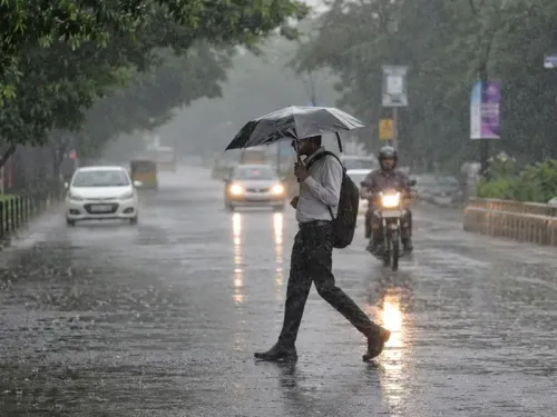
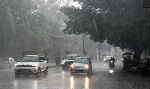
Monsoon lashes Madhya Pradesh: heavy rain, hail and 70 kmph winds hit districts

Synopsis
The southwest monsoon has swept into Madhya Pradesh with unusual early force — 70 kmph gusts in Ashoknagar, hailstorms across four districts, and 72 mm of rain in Bhind in a single morning. With IMD alerts running through 3 June and a Western Disturbance amplifying the system, this is more than seasonal relief: it is a multi-day weather event with real risk to standing crops.
Key Takeaways
The southwest monsoon has advanced into Madhya Pradesh , bringing heavy rain, hailstorms and strong winds as of 30 May .
Gormi, Bhind recorded the highest rainfall at 72 mm by 8:30 am IST on 30 May , according to the IMD .
Wind gusts reached 70 kmph in Ashoknagar ; hailstorms hit Shivpuri , Morena , Sagar and Sheopur .
IMD alerts cover dozens of districts through 3 June , with winds of 50–60 kmph forecast at isolated places.
A Western Disturbance over northwest Uttar Pradesh is amplifying the active weather pattern.
Authorities have urged farmers and residents to take precautions; crop and infrastructure damage is a concern.
The southwest monsoon has advanced further into Madhya Pradesh, unleashing widespread rainfall, thunderstorms, hailstorms and gusty winds across several districts on 30 May. The India Meteorological Department (IMD) has issued multi-day alerts covering dozens of districts through 3 June, even as the weather surge brings welcome relief from a punishing summer.
Rainfall and Wind Records
Gormi in Bhind district logged the highest rainfall of 72 mm as of 8:30 am IST on 30 May, according to the IMD Meteorological Centre, Bhopal. Narwar followed with 44 mm, Tendukheda-Narsinghpur recorded 38 mm, and Berad received 31 mm. Shujalpur and Mohan Garh each recorded 29 mm, while Baldevgarh and Niwari logged 27 mm and 25 mm respectively.
Wind gusts reached 70 kmph in Ashoknagar, 67 kmph in Gwalior and Shivpuri, and 59 kmph in Sehore. Hailstorms were reported across Shivpuri, Morena, Sagar and Sheopur districts.
IMD Alerts: Districts on Watch
The IMD has forecast heavy rainfall with thunderstorms, lightning, hail and winds of 50–60 kmph at isolated places in Mandsaur and Neemuch on 30–31 May. Similar intense activity is expected in Gwalior, Datia, Bhind, Damoh, Chhatarpur, Tikamgarh and Niwari.
From 31 May to 3 June, thunderstorms and strong winds are forecast to continue across large parts of the state, including Rajgarh, Agar, Shahdol, Sehore, Dewas, Indore, Ujjain and Jhabua, with isolated heavy spells possible. Thunderstorms and lightning have already affected the Chambal, Gwalior, Sagar and Ujjain divisions, Rewa division (except Singrauli), Shahdol division, and districts including Jhabua, Dhar, Indore, Dewas, Katni and Dindori.
What Is Driving the Weather
A Western Disturbance over northwest Uttar Pradesh, along with associated troughs running through Pakistan, Rajasthan, Madhya Pradesh and Chhattisgarh, is amplifying the active weather pattern. The monsoon's northern limit is advancing steadily, with the IMD projecting favourable conditions for further progression into parts of the Arabian Sea, Lakshadweep, Kerala, Tamil Nadu and the Bay of Bengal over the next 4–5 days. This early surge is expected to significantly ease heatwave conditions across central India.
Impact on Crops and Precautions Issued
While the rains offer relief, authorities have flagged concerns over potential crop and infrastructure damage from hailstorms and strong winds. Farmers have been specifically advised to take precautionary measures in their fields and avoid exposure during thunderstorms. Residents have been urged to stay hydrated, avoid unnecessary travel during peak storm hours — particularly afternoons — secure loose objects, and shelter livestock. Officials say they are continuing to monitor the situation closely as the monsoon advances.
Point of View
Amplified by a Western Disturbance that is rare company for a pre-June monsoon. The relief from heat is real, but the risk to rabi crop remnants and early kharif sowing is equally real and tends to get underreported in weather coverage. IMD's district-level specificity in its alerts is a positive signal for preparedness, but last-mile communication to farmers in Bhind, Morena and Sheopur — where hail damage can be devastating — remains the weak link in India's agro-weather response chain.
NationPress
14 Oct 2026
Frequently Asked Questions
Which districts in Madhya Pradesh are on IMD alert for heavy rain and storms?
The IMD has issued alerts for dozens of districts including Mandsaur, Neemuch, Gwalior, Datia, Bhind, Damoh, Chhatarpur, Tikamgarh, Niwari, Indore, Ujjain, Sehore, Dewas, Shahdol and Jhabua, among others, through 3 June 2025.
How much rainfall was recorded in Madhya Pradesh on 30 May?
Gormi in Bhind district recorded the highest rainfall at 72 mm as of 8:30 am IST on 30 May, according to the IMD Meteorological Centre in Bhopal. Narwar received 44 mm and Tendukheda-Narsinghpur logged 38 mm.
What is causing the heavy rain and storms in Madhya Pradesh?
A Western Disturbance over northwest Uttar Pradesh, combined with associated troughs across Pakistan, Rajasthan, Madhya Pradesh and Chhattisgarh, is amplifying the southwest monsoon's activity over the state.
How long will the storms and heavy rain continue in Madhya Pradesh?
According to the IMD, thunderstorms and strong winds are expected to continue across large parts of Madhya Pradesh from 31 May through at least 3 June 2025, with isolated heavy spells possible.
What precautions have authorities issued for residents and farmers?
Authorities have advised residents to avoid unnecessary travel during afternoon peak storm hours, secure loose objects and shelter livestock. Farmers have been specifically asked to protect standing crops from hail and strong winds and to avoid exposure during thunderstorms.