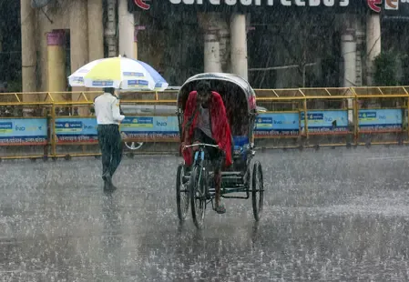
Odisha deep depression: Red alert in 4 districts, landfall in hours

Synopsis
A deep depression moving northwest at 7 kmph is hours from landfall on the north Andhra–south Odisha coast, with Similiguda already recording 230 mm of rain. Four districts are under red alert, 33 ODRAF and 381 fire service teams are deployed, and the system is forecast to drench western Odisha through 26 September — testing the state's celebrated 'zero casualty' disaster model.
Key Takeaways
A deep depression is set to make landfall between Visakhapatnam and Gopalpur within 3–4 hours of the 23 September 2026 forecast.
IMD red warning issued for Kalahandi , Nabarangpur , Koraput , and Malkangiri districts.
Similiguda in Koraput recorded 230 mm of extremely heavy rainfall in 24 hours.
Winds of 55–65 kmph , gusting to 75 kmph , are expected along the coast.
33 ODRAF teams and 381 fire service teams deployed across Odisha.
Chief Minister Mohan Charan Majhi has invoked the state's 'zero casualty' policy and reviewed emergency preparedness.
Several districts of Odisha are reeling under incessant rainfall as a deep depression over the Bay of Bengal moves inland, with the India Meteorological Department (IMD) warning of landfall between Visakhapatnam and Gopalpur within the next three to four hours as of 23 September 2026. The state government has activated emergency protocols and deployed disaster response teams across affected zones.
Storm Position and Landfall Forecast
The deep depression is currently centred approximately 30 km south-southwest of Kalingapatnam in Andhra Pradesh and 160 km southwest of Gopalpur, moving at 7 kmph in a west-northwest direction. IMD Bhubaneswar Director Manorama Mohanty confirmed that the system is expected to cross the north Andhra Pradesh and south Odisha coasts, to the southwest of Kalingapatnam, within hours. Strong winds of 55–65 kmph, gusting up to 75 kmph, are forecast along and near the coast as the system moves inland.
Rainfall Intensity Across Odisha
Widespread rainfall has been recorded across the state in the past 24 hours. Thirty-five locations received heavy rainfall of 7–12 cm, while 10 locations logged very heavy rainfall of 12–20 cm. The most extreme recording was at Similiguda in Koraput district, which received a staggering 230 mm of rainfall — classified as extremely heavy. The IMD has issued a red warning for Kalahandi, Nabarangpur, Koraput, and Malkangiri, signalling imminent danger of heavy to very heavy rainfall with isolated extremely heavy spells.
Multi-Day Rainfall Outlook
The weather system is expected to continue affecting Odisha through at least 26 September. On 24 September, isolated extremely heavy rainfall is forecast for Nabarangpur, with heavy to very heavy rainfall likely across Bargarh, Nuapada, Balangir, Kalahandi, Koraput, and Malkangiri. Heavy to very heavy spells are expected on 25 September in Malkangiri, Koraput, Nabarangpur, Kalahandi, and Nuapada. By 26 September, rainfall is forecast to persist mainly over the western parts of southern Odisha, including Kalahandi, Balangir, Nuapada, and Nabarangpur. Districts such as Rayagada, Gajapati, Ganjam, Puri, Khurda, Nayagarh, Kandhamal, Boudh, Subarnapur, and Bargarh are also on alert for heavy to very heavy rainfall.
Government Response and Deployments
Chief Minister Mohan Charan Majhi on Wednesday chaired a review meeting on the state's preparedness, stressing the government's stated policy of 'zero casualty'. He directed authorities to place the safety of lives and property above all else. In response, 33 Odisha Disaster Rapid Action Force (ODRAF) teams and 381 fire service teams have been deployed across the state. This rapid mobilisation follows a pattern established after cyclones Fani and Amphan, when Odisha's early-response model drew national recognition. Notably, southern and western Odisha — already among the more flood-vulnerable regions — face the brunt of this system, raising concerns about agricultural damage and displacement in tribal-dominated districts.
With the system expected to weaken gradually after landfall, authorities will be closely monitoring river levels and the risk of flash floods in low-lying areas over the coming days.
Point of View
But it is tested anew every monsoon season — and this system is hitting the state's most vulnerable tribal districts in Koraput, Malkangiri, and Kalahandi, where evacuation infrastructure is thinner than in coastal belts. The 230 mm reading at Similiguda signals the kind of flash-flood risk that can overwhelm even well-prepared district machinery within hours. The multi-day outlook extending to 26 September means fatigue risk for deployed teams and sustained pressure on river systems. How the next 72 hours unfold will be the real test of whether early deployment translates to lives saved — or whether the headline metric again masks ground-level gaps in last-mile relief.
NationPress
24 Sept 2026
Frequently Asked Questions
Where is the deep depression expected to make landfall in Odisha?
The deep depression is forecast to cross the north Andhra Pradesh and south Odisha coasts between Visakhapatnam and Gopalpur, to the southwest of Kalingapatnam, within three to four hours of the 23 September 2026 IMD advisory. It was centred about 30 km south-southwest of Kalingapatnam at the time of reporting.
Which Odisha districts are under IMD red alert?
The IMD has issued a red warning for Kalahandi, Nabarangpur, Koraput, and Malkangiri, where heavy to very heavy rainfall with isolated extremely heavy spells is likely. Several other districts, including Ganjam, Puri, Khurda, and Rayagada, are also under heavy-rainfall advisories.
How much rainfall has Odisha recorded so far due to this system?
In the 24 hours preceding the 23 September advisory, 35 locations recorded heavy rainfall of 7–12 cm and 10 locations saw very heavy rainfall of 12–20 cm. Similiguda in Koraput district received the highest recorded amount at 230 mm, classified as extremely heavy rainfall.
What disaster response measures has the Odisha government taken?
Chief Minister Mohan Charan Majhi reviewed the state's preparedness on Wednesday, invoking a 'zero casualty' policy and directing authorities to prioritise lives and property. A total of 33 ODRAF teams and 381 fire service teams have been deployed across the affected districts.
How long will heavy rainfall continue in Odisha?
The IMD forecasts heavy to very heavy rainfall continuing through at least 26 September 2026, with the western parts of southern Odisha — particularly Kalahandi, Balangir, Nuapada, and Nabarangpur — expected to see prolonged rainfall even after the system weakens post-landfall.