MEA rejects China's claims on Ladakh, says UT integral part of India
Synopsis
India's MEA fired back at Beijing after China called the naming of 28 Ladakh locations on the Survey of India map 'illegal and void.' New Delhi's message was unambiguous: Ladakh is an integral and inalienable part of India, and no Chinese denial changes that — a cartographic assertion with real strategic stakes on the LAC.
Key Takeaways
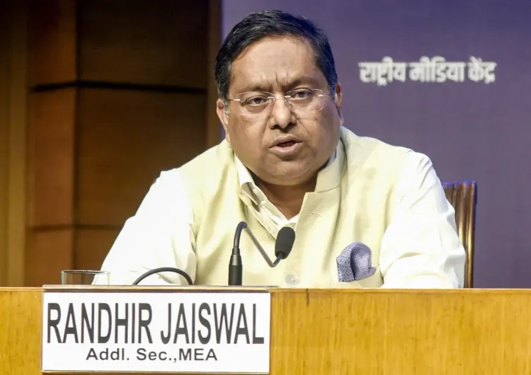
MEA spokesperson Randhir Jaiswal on 13 October 2026 rejected China's objections to India's standardisation of place names in Ladakh .
The Ministry of Home Affairs earlier identified 28 places and geographical features in the UT of Ladakh on the official Survey of India map.
Chinese Foreign Ministry spokesperson Mao Ning had termed the move 'illegal and void.' India stated the naming exercise was done in consultation with the Union Territory of Ladakh and local stakeholders.
The move is seen as a formal cartographic rebuttal to Chinese renaming efforts in disputed border regions, mirroring similar exercises in Arunachal Pradesh .
The Ministry of External Affairs (MEA) on Tuesday, 13 October firmly rejected China's objections to India's naming of 28 geographical locations in the Union Territory of Ladakh, reiterating that Ladakh is an 'integral and inalienable part of India' and that no denial from Beijing can alter that established fact.
India's Official Stand
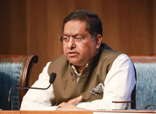
MEA spokesperson Randhir Jaiswal responded to media queries following remarks by Chinese Foreign Ministry spokesperson Mao Ning, who had termed India's standardisation of place names in Ladakh as 'illegal and void.' Jaiswal referred to the Ministry of Home Affairs (MHA) statement and underscored that the exercise was carried out in consultation with the Union Territory of Ladakh and local stakeholders.
'It is reiterated that the UT of Ladakh is an integral and inalienable part of India. No amount of denial by the Chinese side can change this established fact,' Jaiswal said, adding that the announcement by the MHA was 'self-explanatory.'
The 28 Named Locations
Earlier in October, the Centre identified 28 places and geographical features in Ladakh by standard names on the official map of the Survey of India (SoI). The government stated the move was aimed at facilitating accurate recognition and greater public awareness of these locations.
The named features include peaks, passes, glaciers, valleys, and water bodies — among them Atisha Giri Peak, Skamri Glacier, Parpik Glacier, Guru Rinpoche Lake, Zorawar Peak, Milarepa Kangri Peak, Maheshvara Ri Peak, Shkorga Valley, and Gogra Land area, along with 23 other designated features.
Strategic and Cartographic Significance
Standardising place names on the Survey of India map carries considerable administrative, strategic, and legal weight. It establishes uniform, official nomenclature for peaks, passes, rivers, and glaciers — eliminating the risk of duplicate or conflicting local references. Crucially, it converts diplomatic positions into formal cartographic records, effectively serving as an official counter to foreign renaming efforts in contested border regions.
This is not the first time China has objected to India's cartographic assertions. Beijing has previously opposed India's renaming of locations in Arunachal Pradesh, and has itself periodically released lists of renamed places in Indian territory — a move New Delhi has consistently rejected. This pattern reflects a broader strategic rivalry over narrative control in border geography.
Beijing's Objection
Chinese Foreign Ministry spokesperson Mao Ning on Tuesday called the Indian government's move 'illegal and void,' claiming sovereignty over the region. This follows a well-established pattern in which Beijing challenges any Indian administrative action that formally asserts jurisdiction over territories it disputes, including Ladakh and Arunachal Pradesh.
What Comes Next
India's formal cartographic assertion is unlikely to be reversed and sets the administrative baseline for future governance and infrastructure in the region. Diplomatic observers note that such measures — while not resolving boundary disputes — serve to anchor India's legal and administrative position in contested geography. The India-China border dispute, spanning decades, remains unresolved despite recent disengagement steps along the Line of Actual Control (LAC).
Point of View
While predictable, cannot undo the administrative baseline India is now building. What is often missed in coverage of such moves is their cumulative legal value: each formally named peak or glacier becomes a data point in any future boundary adjudication. China does exactly this in territories it claims — India is belatedly returning the favour.
NationPress
13 Oct 2026
Frequently Asked Questions
Why did India name 28 places in Ladakh on the Survey of India map?
India identified 28 geographical features in the Union Territory of Ladakh by standard names on the official Survey of India map to facilitate accurate recognition and public awareness. The government said the exercise was done in consultation with the UT of Ladakh and local stakeholders, and it also serves as a formal cartographic assertion of Indian sovereignty over the region.
What was China's objection to India naming places in Ladakh?
Chinese Foreign Ministry spokesperson Mao Ning termed India's standardisation of place names in Ladakh as 'illegal and void,' claiming Chinese sovereignty over the territory. India's MEA directly rejected this, reiterating that Ladakh is an integral and inalienable part of India.
What places were formally named on the Survey of India map?
The 28 features include peaks such as Atisha Giri Peak, Zorawar Peak, Milarepa Kangri Peak, and Maheshvara Ri Peak; glaciers including Parpik Glacier and Skamri Glacier; Guru Rinpoche Lake; Shkorga Valley; and Gogra Land area, among others spread across the Union Territory of Ladakh.
Is this the first time China has opposed India's cartographic actions in border areas?
No. China has previously objected to India renaming locations in Arunachal Pradesh and has itself released lists of renamed places in Indian territory, which New Delhi has consistently rejected. Both sides have engaged in competing cartographic assertions as part of a broader strategic rivalry over narrative control in disputed border regions.
What is the strategic significance of standardising place names in Ladakh?
Standardising names on the Survey of India map establishes official, uniform nomenclature and converts India's diplomatic positions into formal cartographic and legal records. This is particularly significant in contested border areas like Ladakh and Arunachal Pradesh, where it serves as an official counter to foreign renaming efforts and anchors India's administrative position in any future boundary discussions.