China maps South China Sea floor at twice Western resolution

Synopsis
China has mapped the South China Sea floor at twice the resolution and up to five times the accuracy of Western methods — a 20-year effort whose strategic value was brutally illustrated when the USS Connecticut struck an uncharted seamount in the same waters in 2021.
Key Takeaways
China has mapped the South China Sea seabed at twice the resolution and up to five times the accuracy of methods used by other countries.
The project took more than two decades and was led by the Second Institute of Oceanography under the Ministry of Natural Resources .
The USS Connecticut , a Seawolf-class nuclear submarine, struck an uncharted seamount in the South China Sea on 2 October 2021 , injuring 11 crew members .
Key platforms used include the AUV Orange Shark III and deep-sea vehicle Qianlong .
The project received a National Science and Technology Progress Award , China's top state science honour.
Whether the dataset will be shared publicly, academically, or kept classified has not been disclosed.
China has completed a high-resolution seabed mapping project covering its claimed waters in the South China Sea, achieving twice the resolution and up to five times the accuracy of comparable methods used by other countries, according to scientists involved in the effort. The project, which spanned more than two decades, was led under the auspices of the Ministry of Natural Resources and represents one of the most comprehensive ocean-floor surveys ever conducted in the region.
Why it matters
The strategic value of precise bathymetric data was made starkly clear on 2 October 2021, when the US Navy's Seawolf-class nuclear submarine USS Connecticut struck an uncharted seamount while submerged in the South China Sea. The collision grounded the vessel and injured 11 crew members. A subsequent investigation attributed the accident to poor voyage planning by officers on watch, who failed to act on sonar warnings that did not match their navigational charts.
Scientists involved in the Chinese project noted that had detailed topographic data for that area been available, the billion-dollar advanced submarine might well have avoided the mishap — underscoring the direct operational consequences of incomplete ocean-floor intelligence.
The technology behind the survey
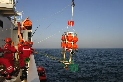
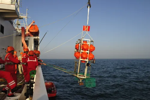
The mapping effort relied on a fleet of autonomous underwater vehicles (AUVs), including the domestically developed Orange Shark III and the deep-sea platform Qianlong, according to reports. These systems enabled the Second Institute of Oceanography — the lead research body — to gather data at depths and resolutions previously unattainable with conventional survey vessels. The project was recognised with a National Science and Technology Progress Award, China's highest state-level science honour.
Competitive backdrop
Accurate seabed mapping is a prerequisite for three overlapping strategic priorities: covert submarine navigation, deep-sea mineral extraction, and geophysical research into ocean currents and earthquake dynamics. The South China Sea sits atop estimated reserves of oil, gas, and rare-earth minerals, and its contested territorial status — with rival claims from China, Vietnam, the Philippines, and others — makes hydrographic superiority a meaningful geopolitical asset. Russia has conducted similar extended mapping campaigns in the Arctic, but no comparable high-resolution public dataset exists for the South China Sea from any other state actor.
What's next
Details of the dataset's accessibility — whether it will be shared with academic institutions, regional partners, or kept within classified government systems — have not been disclosed. The Science and Technology Daily and China Natural Resources News reported on the achievement, suggesting a degree of deliberate public signalling by Beijing. As deep-sea resource competition and submarine operations in the region intensify, the geopolitical weight of controlling the most accurate seabed map of the South China Sea is likely to grow considerably.
Point of View
Regional navies, and Washington that it now holds the most granular picture of the South China Sea floor in existence. The USS Connecticut incident is not incidental context — it is the implicit argument for why hydrographic superiority translates directly into military advantage. What mainstream coverage tends to underplay is the dual-use nature of this data: the same high-resolution maps that guide submarine navigation also pinpoint the most viable corridors for deep-sea cable laying, mineral extraction, and the placement of underwater sensor arrays. As the broader tech-military competition between the US and China shifts increasingly to undersea domains, controlling the definitive bathymetric dataset of the world's most contested waterway is a structural advantage that compounds over time.
NationPress
15 Oct 2026
Frequently Asked Questions
What did China achieve with its South China Sea seabed mapping project?
China mapped the seabed of its claimed waters in the South China Sea at twice the resolution and up to five times the accuracy of methods used by other countries. The effort took more than two decades and was led by the Second Institute of Oceanography under the Ministry of Natural Resources .
What happened to the USS Connecticut in the South China Sea?
The USS Connecticut , a Seawolf-class nuclear submarine, struck an uncharted seamount while submerged in the South China Sea on 2 October 2021 , injuring 11 crew members . An investigation found that officers on watch failed to act on sonar warnings that did not match their navigational charts.
What technology did China use to map the South China Sea floor?
The survey relied on autonomous underwater vehicles ( AUVs ), including the Orange Shark III and the deep-sea platform Qianlong . These domestically developed systems allowed researchers to collect data at depths and resolutions beyond the reach of conventional survey ships.
Why does seabed mapping matter strategically?
Precise bathymetric data is essential for submarine navigation, deep-sea mineral extraction, and research into ocean currents and earthquakes. In contested waters like the South China Sea , the country with the most accurate seabed map holds a meaningful advantage in both military operations and resource development.
Will China share its South China Sea seabed data publicly?
It has not been disclosed whether the dataset will be made available to academic institutions, regional partners, or kept within classified government systems. Reporting by Science and Technology Daily and China Natural Resources News suggests Beijing is deliberately publicising the achievement, though the underlying data remains undisclosed.