Great Nicobar Island ₹81,000 crore project: India's strategic and economic gambit

Synopsis
India's ₹81,000 crore Great Nicobar Island Development Project is far more than an infrastructure scheme — it is a calculated bid to anchor India's presence at one of the world's most critical maritime chokepoints, the Strait of Malacca, while simultaneously unlocking a third of the country's total EEZ. If it delivers, it could redraw the Indo-Pacific strategic map.
Key Takeaways
The government has approved the ₹81,000 crore Great Nicobar Island Development Project (GNIDP) , encompassing a transhipment port, international airport, township, and power plant.
Galathea Bay offers a 20-metre deep-water draft and sits 40 nautical miles from the East-West shipping line through the Strait of Malacca .
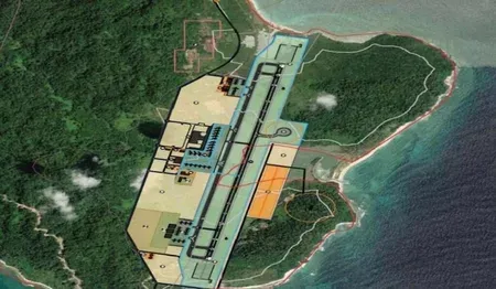
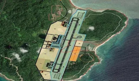
The dual-use Greenfield International Airport will handle up to 4,000 passengers per hour and support both civilian and military operations.
The Andaman and Nicobar Islands generate an EEZ of roughly 6 lakh sq km — about a third of India's total EEZ under UNCLOS .
Of 18 lakh trees in the affected zone, 7.1 lakh will be felled over 30 years ; 2.4 lakh trees already planted, with 6 lakh more pledged before Phase 1 begins.
Offshore oil exploration in the islands began only in 2020 , with potential discoveries adding further strategic value.
The Andaman and Nicobar Islands are set to emerge as a pivotal strategic and commercial asset for India, following the government's approval of the ₹81,000 crore Great Nicobar Island Development Project (GNIDP) — an initiative that aims to simultaneously bolster national security, unlock maritime trade potential in the Bay of Bengal, and establish a model of sustainable development.
What the GNIDP Entails
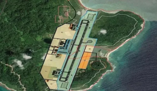
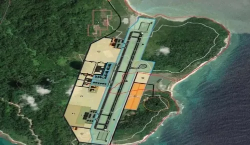
The project envisions transforming Great Nicobar Island (GNI) into a multimodal hub anchored by four key components: a transhipment port, a Greenfield International Airport, an integrated township, and a 450 MVA power plant. The airport is designed to handle up to 4,000 passengers per hour at peak capacity and will serve both civilian and military operations. The power plant will supply energy to the International Container Transhipment Terminal (ICTT) and the integrated township, which encompasses two new greenfield cities at Campbell Bay and Galathea Bay, alongside a cruise terminal, luxury resorts, and industrial facilities.
Geography as a Strategic Asset
Great Nicobar Island lies just 40 nautical miles from the East-West shipping line — the Six Degree Channel — which passes through the Strait of Malacca, one of the world's busiest maritime corridors. Galathea Bay, situated at the island's southern tip, offers a natural deep-water draft of 20 metres, making it capable of accommodating large super tankers and positioning it as an ideal transhipment port. This marks the first comprehensive attempt to integrate national security objectives with regional economic development in the Bay of Bengal.
Strategic and Defence Significance
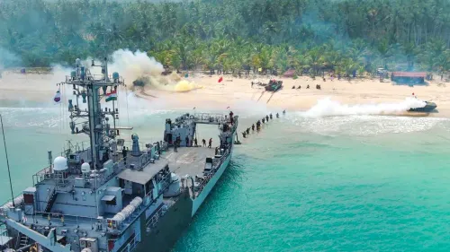
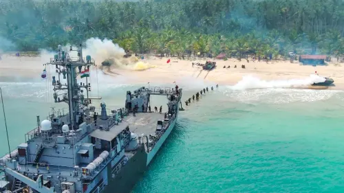
Once operational, the dual-use airport could station combat aircraft while the ICTT could host battleships, extending surveillance across the Andaman Sea and into the South China Sea. The Six Degree Channel is also a crossing point for military vessels transiting between the Indian Ocean and the Pacific Ocean, adding another layer of strategic value to Galathea Bay as a monitoring station for military movements. Additionally, offshore oil exploration in the islands — which only commenced in 2020, after the area's longstanding designation as a 'no-go zone' for oil was lifted — raises the prospect of energy discoveries that could further amplify the project's significance.
Economic and Maritime Leverage
The Andaman and Nicobar archipelago, with a coastline of approximately 1,962 kilometres, generates an Exclusive Economic Zone (EEZ) of roughly 6 lakh square kilometres in the eastern Indian Ocean under the United Nations Convention on the Law of the Sea (UNCLOS) — accounting for nearly a third of India's total EEZ. Establishing a world-class transhipment hub here could redirect significant Bay of Bengal cargo traffic that currently transits through competing regional ports.
Environmental Safeguards and Tribal Protections
The project has drawn scrutiny over its ecological footprint, but officials point to built-in protections. Of the 130 sq km of forest area affected, 65 sq km is classified as green and will remain untouched. Of the 18 lakh trees in the remaining area, 7.1 lakh will be felled over the next 30 years. Notably, 2.4 lakh trees have already been planted under the 'Ek Ped Maa Ke Naam' scheme before a single tree has been cut, with an additional 6 lakh trees planned before Phase 1 begins — meaning total plantings will exceed the number of trees to be removed. The project is also mandated to leave the island's indigenous tribal communities and their habitations undisturbed.
With approvals in place and environmental frameworks reportedly active, the GNIDP represents India's most ambitious attempt yet to convert its island geography into durable strategic and economic power — and how it executes will be watched closely across the Indo-Pacific.
Point of View
Environmental clearances, and inter-ministerial friction. The ecological commitments — more trees planted than cut — are a politically smart framing, but independent monitoring of tribal protections and biodiversity impact remains conspicuously thin in official disclosures. China's rapid militarisation of the South China Sea makes the strategic case urgent; the harder question is whether India's infrastructure delivery machinery can match the geopolitical ambition.
NationPress
16 Oct 2026
Frequently Asked Questions
What is the Great Nicobar Island Development Project (GNIDP)?
The GNIDP is a ₹81,000 crore infrastructure initiative approved by the Indian government to develop Great Nicobar Island into a multimodal hub comprising a transhipment port, a dual-use international airport, an integrated township with two greenfield cities, and a 450 MVA power plant. It is designed to serve both strategic defence and commercial maritime objectives in the Bay of Bengal.
Why is Great Nicobar Island strategically important for India?
Great Nicobar Island sits just 40 nautical miles from the Six Degree Channel and the Strait of Malacca — among the world's busiest shipping corridors. Its position allows India to monitor and potentially control maritime traffic between the Indian Ocean and the Pacific Ocean, and Galathea Bay's 20-metre natural draft can accommodate super tankers and warships alike.
How large is India's Exclusive Economic Zone around the Andaman and Nicobar Islands?
Under UNCLOS, the Andaman and Nicobar archipelago's roughly 1,962-kilometre coastline generates an EEZ of approximately 6 lakh square kilometres in the eastern Indian Ocean — about a third of India's total EEZ. This vast maritime territory holds significant fisheries, energy, and strategic value.
What environmental measures are in place for the GNIDP?
Of the 130 sq km of forest area affected, 65 sq km will remain entirely untouched. Of the 18 lakh trees in the remaining zone, only 7.1 lakh will be felled over 30 years. Before any felling begins, 2.4 lakh trees have already been planted under the 'Ek Ped Maa Ke Naam' scheme, with 6 lakh more pledged before Phase 1 starts — making total plantings greater than total removals.
Will the GNIDP affect indigenous tribes on Great Nicobar Island?
The project is officially mandated not to disturb indigenous tribal communities or their habitations on Great Nicobar Island. Tribal protection is listed as a high-priority condition of the project's approval, though independent oversight mechanisms have not been publicly detailed.