Assam CM Office: Flood Fight on Jamuna, Charaideo, Jorhat
Synopsis
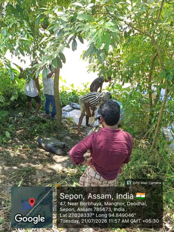
The Chief Minister's Office of Assam confirmed on 21 July 2026 that the Water Resources Department is carrying out emergency flood-fighting operations along the Jamuna River in Karbi Anglong and restoration works at Sagarbera in Charaideo and Dhontola on the Jhanji left bank embankment in Jorhat.
Key Takeaways
The Jamuna River overtopped its banks following heavy rainfall in the upper reaches of Karbi Anglong , triggering emergency response on 21 July 2026 .
The Water Resources Department is conducting flood-fighting works at affected sites along the Jamuna simultaneously with restoration works at two other locations.
Restoration work near Sagarbera is being handled by the Charaideo Water Resources Division .
The Jorhat Water Resources Division is working on the Jhanji left bank embankment at Dhontola .
These operations are part of Assam's annual monsoon flood-management cycle under the central Flood Management Programme active since 2007-08 .
Riverine farmers, villagers along the floodplain, and WRD field staff are the primary stakeholders in the ongoing response.
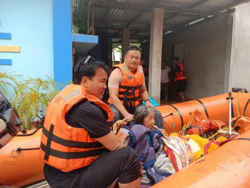
The Chief Minister's Office of Assam on Tuesday, 21 July 2026, confirmed that emergency flood-fighting operations are actively underway at multiple locations across the state following heavy rainfall in the upper reaches of Karbi Anglong that caused the Jamuna River to overtop its banks.
What Is Happening on the Ground
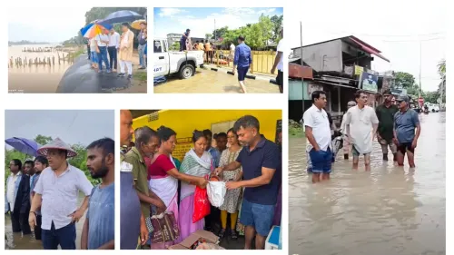
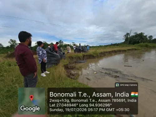
The CMO's update states that 'flood fighting works are underway at locations affected by the overtopping of the Jamuna River following heavy rainfall in the upper reaches of Karbi Anglong.' The Water Resources Department (WRD) has simultaneously deployed teams for flood protection and restoration works at two additional sites: near Sagarbera under the Charaideo Water Resources Division, and at Dhontola along the Jhanji left bank embankment under the Jorhat Water Resources Division. The deployment of field staff across three distinct divisional areas signals a multi-front response to what appears to be a broad monsoon surge.Context: Why Karbi Anglong Triggers Downstream Flooding
The Jamuna River originates in the hilly terrain of Karbi Anglong, a district in central Assam whose steep upper catchment channels rainfall rapidly into the river system. Intense precipitation in these upper reaches can cause the river to overtop embankments in downstream stretches within hours, leaving little preparation time for affected communities. Assam experiences this cycle annually during the southwest monsoon, with the Brahmaputra and its tributaries — including the Jamuna and Jhanji — among the most flood-prone river systems in South Asia.Policy Backdrop: Annual Flood Management Cycle
The WRD's response follows a well-established framework. Assam has been implementing the central Flood Management Programme (FMP) since 2007-08, aimed at raising and strengthening embankments along the Brahmaputra and its tributaries. From 2010 onward, the state has also drawn on the Assam Integrated Flood and Riverbank Erosion Risk Management Programme, backed by the Asian Development Bank, to fund more durable embankment construction and emergency repair capacity. Pre-monsoon and in-season flood-fighting works by the WRD are a standard part of this annual cycle, not one-off interventions.Stakeholders and Impact
The communities most directly affected are riverine farmers and villagers settled along the Jamuna floodplain and near the Jhanji left bank in Jorhat district, as well as residents in the Charaideo area near Sagarbera. Embankment overtopping can inundate agricultural land, damage standing kharif crops, and displace households — losses that compound over successive flood events within a single season. WRD field staff conducting the works also face hazardous conditions during active flood events.What's Next
The Assam State Disaster Management Authority (ASDMA) is expected to issue updates on relief distribution and any additional embankment breaches reported in other districts as the monsoon season progresses. With the upper catchments of Karbi Anglong still receiving rainfall, authorities will be monitoring river levels closely to determine whether further emergency interventions are needed at other vulnerable stretches across the state.Point of View
Charaideo, and Jorhat — underscores that this is not an isolated event but part of a systemic annual burden the state has struggled to reduce despite decades of embankment investment. The reliance on emergency flood-fighting works rather than long-term structural solutions points to a persistent gap between the scale of Assam's flood risk and the durability of its infrastructure. Until upper-catchment watershed management is integrated with downstream embankment policy, reactive interventions will remain the dominant mode of flood response in the state.
NationPress
21 Jul 2026
Frequently Asked Questions
Why did the Jamuna River overtop its banks in Assam in July 2026?
Heavy rainfall in the upper reaches of Karbi Anglong caused a rapid surge in the Jamuna River, leading it to overtop its banks and affect downstream areas. The Jamuna originates in the hilly Karbi Anglong terrain, where intense monsoon rainfall drains quickly into the river system.
What is the Water Resources Department doing about the Assam floods?
The Water Resources Department is carrying out flood-fighting works along the Jamuna River and conducting flood protection and restoration works near Sagarbera under the Charaideo Water Resources Division and at Dhontola on the Jhanji left bank embankment under the Jorhat Water Resources Division.
Which districts in Assam are affected by floods in July 2026?
Based on the official update from the Chief Minister's Office, the areas affected include locations along the Jamuna River linked to Karbi Anglong, as well as Sagarbera in Charaideo district and Dhontola near the Jhanji river in Jorhat district.
What is Assam's Flood Management Programme?
The Flood Management Programme (FMP) is a central government initiative implemented in Assam since 2007-08 to raise and strengthen embankments along the Brahmaputra and its tributaries. It forms part of the state's annual flood-management framework alongside the Asian Development Bank-supported Assam Integrated Flood and Riverbank Erosion Risk Management Programme.
What should flood-affected residents in Assam do during the 2026 monsoon?
Residents in flood-prone areas along the Jamuna, Jhanji, and other rivers should follow advisories from the Assam State Disaster Management Authority (ASDMA), which is expected to issue updates on relief distribution and any new embankment breaches as the monsoon season continues.