Assam CM Office Monitors Rising River Levels Across State
Synopsis
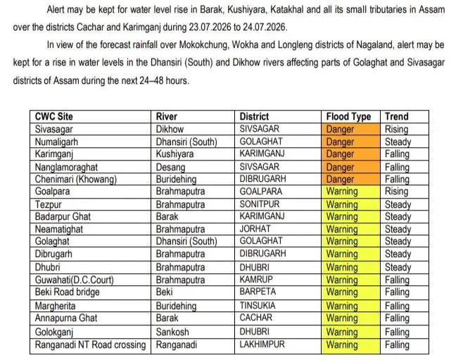
The Chief Minister's Office of Assam on 24 July 2026 flagged mixed river-level trends across the state, with some gauges rising and others receding. Field agencies are on alert and prepared for timely response as the monsoon season remains active.
Key Takeaways
The Chief Minister's Office of Assam issued a river-level update on 24 July 2026 .
River gauges across Assam show a mixed picture — some recording rising trends, others receding.
Field agencies have been placed on high alert and are ready for timely response .
The update reflects Assam's proactive flood-monitoring approach during the peak southwest monsoon period.
Key rivers under watch include the Brahmaputra and multiple tributaries draining Himalayan catchments.
Districts such as Dhubri , Barpeta , Morigaon , and Kaziranga are among the most vulnerable during high-water events.
The Chief Minister's Office of Assam issued a flood-watch update on Friday, 24 July 2026, stating that river levels across the state are under close surveillance, with some gauges recording rising trends while others show signs of receding. Field agencies have been placed on high alert and are prepared for timely response to any emergency.
Context
Assam is one of India's most flood-prone states, with the Brahmaputra and its numerous tributaries — including the Barak, Kopili, Subansiri, and Dhansiri — swelling annually during the southwest monsoon season between June and September. The river systems drain a vast Himalayan catchment, making water levels highly sensitive to upstream rainfall in Arunachal Pradesh, Meghalaya, and parts of China.
The CM Office's post notes that gauges across the state are showing mixed signals — some rising, some receding — a pattern typical of the mid-monsoon phase when rainfall is uneven across sub-catchments. The update signals that the situation has not yet crossed into crisis, but warrants sustained vigilance.
Policy Backdrop
Assam's flood management framework involves multiple agencies: the Assam State Disaster Management Authority (ASDMA), the Central Water Commission (CWC), and district-level administration. The CWC maintains real-time gauge stations at key points along the Brahmaputra and its tributaries, issuing flood forecasts that feed into the state's early-warning system.
In recent years, the state government has invested in strengthening embankments, deploying National Disaster Response Force (NDRF) teams pre-emptively, and using digital dashboards to track water levels in near real-time. The emphasis on 'timely response' in the CM Office's update reflects this institutional shift toward proactive rather than reactive flood management.
Stakeholders and Impact
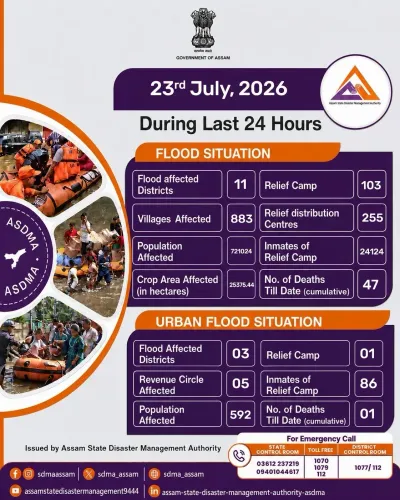
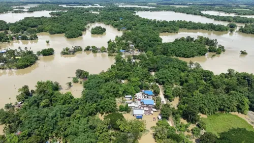
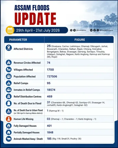
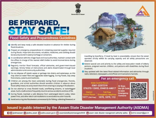
Assam's annual floods affect millions of residents across low-lying districts such as Dhubri, Barpeta, Morigaon, Goalpara, and Kaziranga. Agricultural land, livestock, and critical infrastructure including roads and embankments face recurring damage each monsoon season, with the state reporting significant crop-area losses in flood years.
Wildlife is also at risk: the Kaziranga National Park, a UNESCO World Heritage Site and home to the one-horned rhinoceros, floods partially every year, forcing animals onto elevated highland areas. Field agencies on alert include district disaster response teams, NDRF units, and river police, all of whom coordinate rescue and relief operations when water levels breach danger marks.
What's Next
With monsoon season still at its peak, water levels are expected to remain dynamic over the coming weeks. Authorities will continue round-the-clock monitoring at gauge stations, and any breach of danger levels at key points is likely to trigger evacuation advisories for vulnerable riverine communities.
The CM Office's proactive communication signals that the administration is committed to keeping the public informed in real time — a practice that has become increasingly important as climate variability makes Assam's flood patterns less predictable from year to year.
Point of View
The administration is calibrating public anxiety while keeping field agencies mobilised. This approach aligns with the national push under the Sendai Framework for disaster risk reduction, which emphasises early warning and early action. The pattern also reflects political awareness: timely communication during flood season has become a key metric by which voters in riverine Assam judge their government's responsiveness.
NationPress
24 Jul 2026
Frequently Asked Questions
Are Assam rivers flooding in July 2026?
As of 24 July 2026 , river levels across Assam show mixed trends — some gauges are rising while others are receding. The situation is being closely monitored by field agencies but no widespread flood emergency has been declared in this update.
Which rivers are being monitored in Assam during monsoon 2026?
The Brahmaputra and its major tributaries including the Barak , Kopili , Subansiri , and Dhansiri are among the key rivers monitored during the monsoon season in Assam.
Which agency monitors flood levels in Assam?
Flood monitoring in Assam involves the Assam State Disaster Management Authority (ASDMA) , the Central Water Commission (CWC) , and district-level administration, with NDRF teams deployed for on-ground response.
Which districts in Assam are most affected by floods?
Districts such as Dhubri , Barpeta , Morigaon , Goalpara , and areas around Kaziranga National Park are historically among the most vulnerable to annual flooding in Assam.
What does 'field agencies on alert' mean in Assam flood updates?
It means district disaster response teams, NDRF units, river police, and other emergency services are positioned and ready to conduct rescue, evacuation, and relief operations if water levels breach danger marks.