Assam CM Office: Three Rivers Above Danger Level, Falling
Synopsis
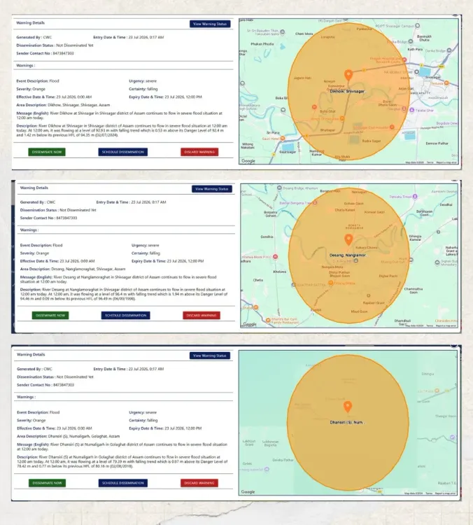
The Chief Minister's Office of Assam on 23 July 2026 confirmed that the Desang at Nanglamora Ghat, the Dikhow at Sivasagar and the Dhansiri (South) at Numaligarh in Golaghat continue to flow above danger levels, though all three rivers are registering a falling trend with monitoring measures in place.
Key Takeaways
Three rivers — Desang (Nanglamora Ghat, Sivasagar), Dikhow (Sivasagar) and Dhansiri South (Numaligarh, Golaghat) — remain above their danger levels as of 23 July 2026 .
All three rivers are showing a falling trend , signalling a possible easing of peak-flood pressure.
State monitoring and flood-response measures remain fully active across affected districts.
Sivasagar and Golaghat are among Assam's most flood-prone districts, with agricultural and tea-growing communities at risk.
The Brahmaputra Board , set up in 1980, oversees long-term flood management in the basin, though annual inundation remains a recurring challenge.
Subsequent Central Water Commission bulletins and upstream rainfall patterns will determine whether the falling trend holds.
The Chief Minister's Office of Assam issued a flood update on Thursday, 23 July 2026, confirming that three rivers in upper Assam remain above their danger levels but are registering a falling trend. The rivers in question are the Desang at Nanglamora Ghat in Sivasagar, the Dikhow at Sivasagar, and the Dhansiri (South) at Numaligarh in Golaghat district.
Context
The official update states that while all three rivers continue to flow above the danger mark, they are showing a falling trend. Monitoring and response measures remain in place across the affected districts. The post provides no specific gauge readings but signals that the immediate peak-flood pressure may be easing.
Sivasagar and Golaghat are among the districts most regularly inundated during the June–September monsoon season. Sivasagar, historically the capital of the Ahom kingdom, lies in the flood path of Brahmaputra tributaries including the Dikhow, while Golaghat's agricultural and tea-growing belts are perennially vulnerable to the Dhansiri's seasonal rise.
Policy Backdrop
Assam's flood crisis is structural, not episodic. The Brahmaputra and its tributaries carry enormous sediment loads from upstream catchments, raising riverbed levels over decades and compressing the margin between normal flow and danger thresholds. The Brahmaputra Board, constituted in 1980, was tasked with coordinating flood control and river management across the basin, though embankment breaches and riverbank erosion remain persistent challenges.
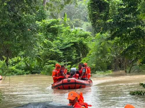
State administrations maintain a network of river gauges and issue tiered public alerts during the monsoon. District-level disaster response mechanisms — including pre-positioned boats, relief camps and coordination with the National Disaster Response Force (NDRF) — are typically activated when rivers breach danger levels. The CMO's bulletin is part of this routine but essential public-communication infrastructure.
Stakeholders and Impact
The most immediate stakeholders are flood-affected residents in low-lying areas along the Desang, Dikhow and Dhansiri river corridors. Agricultural communities in Golaghat — home to some of Assam's most productive tea estates and paddy fields — face crop damage and displacement when river levels stay elevated for extended periods.
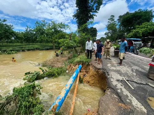
Infrastructure including roads, embankments and bridges in Sivasagar and Golaghat districts is also at risk during sustained high-water events. The falling trend reported in the update offers some relief, but communities remain on alert given the unpredictability of upstream rainfall during the active monsoon months.
What's Next
The CMO's update notes that monitoring and response measures remain in place, indicating that authorities have not yet stood down flood-response operations. Subsequent daily river bulletins from the Central Water Commission will be closely watched to confirm whether the falling trend is sustained or reversed by fresh upstream rainfall.
If water levels rise again, state authorities may seek central assistance or deploy additional NDRF teams to the affected districts. The coming 48–72 hours of rainfall activity over the upper Brahmaputra catchment will be critical in determining the trajectory of the flood situation across Sivasagar and Golaghat.
Point of View
And each monsoon season renews pressure on both the state and the Centre to move toward basin-level water management. The update's brevity and factual tone suggest the state is in active-monitoring mode rather than emergency-escalation mode, which itself is a calibrated signal to affected communities and relief machinery.
NationPress
23 Jul 2026
Frequently Asked Questions
Which rivers are above danger level in Assam on 23 July 2026?
The Desang at Nanglamora Ghat in Sivasagar, the Dikhow at Sivasagar and the Dhansiri (South) at Numaligarh in Golaghat are all flowing above the danger level as of 23 July 2026, though all three are showing a falling trend.
Is the Assam flood situation improving?
According to the Chief Minister's Office of Assam, all three rivers flagged in the 23 July 2026 update are showing a falling trend, which suggests the immediate peak-flood pressure may be easing, though monitoring and response measures remain active.
Which districts in Assam are affected by floods in July 2026?
Sivasagar and Golaghat districts are the focus of the 23 July 2026 flood update, with the Desang and Dikhow rivers affecting Sivasagar and the Dhansiri (South) affecting the Numaligarh area of Golaghat.
What is the Brahmaputra Board and what does it do?
The Brahmaputra Board was constituted in 1980 to coordinate flood control and river management across the Brahmaputra basin, including Assam. It works on embankment planning, erosion control and water resource development across the northeastern region.
Why does Assam flood every year?
Assam floods annually due to heavy monsoon rainfall over the Brahmaputra basin, high sediment loads that raise riverbeds over time, and the flat topography of the Brahmaputra valley, which limits natural drainage and makes communities along tributaries like the Dikhow and Dhansiri especially vulnerable.