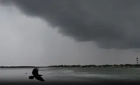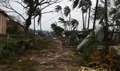


Bay of Bengal cyclone to hit Andhra coast as very severe storm, south Bengal on alert

Synopsis
A Bay of Bengal deep depression is tracking toward the Andhra Pradesh coast and could arrive as a very severe cyclonic storm packing gusts up to 145 kmph — an unusually intense landfall for November. South Bengal won't take a direct hit, but coastal districts from South 24 Parganas to Howrah face heavy rain and 40–50 kmph winds from Thursday.
Key Takeaways
A deep depression in the Bay of Bengal is forecast to intensify into a very severe cyclonic storm before hitting the Andhra Pradesh coast within two days of Tuesday, 17 November 2026 .
Projected landfall wind speeds: 120–130 kmph sustained, with gusts up to 145 kmph .
The IMD says an extended sea track will allow the system to gain considerable strength.
South Bengal districts — South 24 Parganas, East Midnapore, West Midnapore, Jhargram and Howrah — face heavy rain and 40–50 kmph gusts from Thursday .
Kolkata may see scattered rain and thunderstorms continuing through Saturday ; North Bengal is not expected to be affected.
A deep depression over the southeast Bay of Bengal is likely to intensify into a very severe cyclonic storm and make landfall along the Andhra Pradesh coast within the next two days, the India Meteorological Department (IMD) warned on Monday, 16 November 2026. The system is projected to arrive with wind speeds of 120–130 kmph and gusts reaching 145 kmph, posing a significant threat to coastal communities.
Intensification Timeline
According to the IMD, the depression was tracking north-northwestwards at approximately 8 kmph and had already deepened into a deep depression by 11:30 pm on Sunday. At that point it was centred about 670 km west of Srivijayapuram in the Andaman and Nicobar Islands, 640 km east-northeast of Trincomalee in Sri Lanka, 760 km east-southeast of Chennai, 870 km south-southeast of Visakhapatnam, and 980 km south-southeast of Gopalpur in Odisha.
The system is forecast to organise into a cyclonic storm by Monday evening, gain further strength on Tuesday, and develop into a severe cyclonic storm by Tuesday evening. Meteorologists noted that an extended sea track will allow the system to accumulate considerable energy before making landfall.
Projected Landfall and Wind Threat
The storm is expected to reach the Andhra Pradesh coast approximately two days after Tuesday, with landfall projected at the very severe cyclonic storm category. Sustained winds of 120–130 kmph with gusts up to 145 kmph are anticipated at landfall. Coastal districts of Andhra Pradesh face the most direct risk from storm surge, strong winds, and heavy rainfall as the system approaches.
This comes at a time when the Bay of Bengal's post-monsoon cyclone season — typically active between October and December — has historically produced some of India's most destructive storms, including several that targeted the Andhra-Odisha coastline.
Impact on South Bengal and Kolkata
Although the system is not expected to make a direct hit on West Bengal, its outer bands will influence weather across the southern part of the state from Wednesday onwards. The IMD has forecast heavy rainfall in parts of South 24 Parganas, East Midnapore, West Midnapore, Jhargram, and Howrah from Thursday, with gusty winds of 40–50 kmph likely in these districts.
Kolkata and other southern districts may receive scattered rain accompanied by thunderstorms. Such conditions are forecast to persist through Saturday. North Bengal, however, is unlikely to be affected, with dry weather expected to continue there.
Kolkata Temperature and Local Conditions
Kolkata recorded a minimum temperature of 22.2 degrees Celsius on Monday morning, running 1.9 degrees above normal, while Sunday's maximum of 29.2 degrees Celsius was 1.4 degrees below normal. The IMD does not anticipate any significant temperature change across the city over the coming days. The department added that the system's exact track and rate of intensification will determine the precise distribution and intensity of rainfall across affected districts in the days ahead.
Point of View
Where evacuation infrastructure remains uneven despite decades of cyclone experience. The 120–130 kmph wind forecast at landfall is well within a destructive range, and the extended sea track that supercharges the storm also compresses the response window. Authorities in both states should treat this as a high-confidence threat, not a probabilistic one.
NationPress
16 Nov 2026
Frequently Asked Questions
Where is the Bay of Bengal cyclone expected to make landfall?
The system is forecast to make landfall along the Andhra Pradesh coast, arriving approximately two days after Tuesday, 17 November 2026. The IMD projects landfall as a very severe cyclonic storm with wind speeds of 120–130 kmph and gusts up to 145 kmph.
How strong could the cyclone be when it hits Andhra Pradesh?
The IMD forecasts the system will reach the very severe cyclonic storm category at landfall, bringing sustained winds of 120–130 kmph and gusts reaching 145 kmph. Meteorologists say an extended period over the sea will allow it to gather considerable strength.
Will the cyclone affect West Bengal and Kolkata?
West Bengal is not expected to face a direct hit, but the system's outer bands will bring heavy rain to South 24 Parganas, East Midnapore, West Midnapore, Jhargram, and Howrah from Thursday, with gusty winds of 40–50 kmph. Kolkata may see scattered rain and thunderstorms continuing through Saturday.
When did the deep depression form and where was it located?
The system deepened into a deep depression by 11:30 pm on Sunday, 15 November 2026. At that time it was centred about 670 km west of Srivijayapuram in the Andaman and Nicobar Islands, and 760 km east-southeast of Chennai.
Will North Bengal be affected by the cyclone?
No, North Bengal is unlikely to be affected. The IMD expects dry weather to continue in North Bengal while the system's influence remains confined to south Bengal coastal and adjoining districts.