CM Fadnavis clears Mumbai Metro Line 12-A, 18.40 km Manpada-Taloja corridor
Synopsis
Maharashtra's Cabinet Infrastructure Committee, chaired by CM Devendra Fadnavis, has approved the 18.40 km elevated Mumbai Metro Line 12-A from Manpada–Katai Naka to Taloja via Kalyan Phata, with 12 stations, integrated flyovers, bullet-train interchange, and a 3.5-year completion deadline.
Key Takeaways
Mumbai Metro Line 12-A — an 18.40 km fully elevated corridor from Manpada–Katai Naka to Taloja via Kalyan Phata — has received Cabinet Infrastructure Committee approval.
The line will have 12 stations and projected daily ridership of 4,74,000 passengers , with feeder buses at every station.
Integrated flyovers of 6.93 km (four-lane) and 8.69 km (six-lane) are embedded within the same structure.
Interchanges are planned with Metro Lines 12 and 14 , the Mumbai–Ahmedabad Bullet Train at Katai Naka, and Navi Mumbai Metro Line 1 at Amandoot.
MMRDA has been designated Special Planning Authority and authorised to receive government land for transit-oriented development and project funding.
CM Fadnavis set a 3.5-year completion deadline and ordered acceleration of all ongoing state metro projects.
A stretch of suburban Mumbai that industry built but transit forgot is finally getting its metro link. The Cabinet Infrastructure Committee of Maharashtra, chaired by Chief Minister Devendra Fadnavis, on Tuesday, 27 October 2026, approved Mumbai Metro Line 12-A — an 18.40 km elevated corridor connecting Manpada–Katai Naka to Taloja via Kalyan Phata, threading through some of the most congested freight-and-commute terrain in the Mumbai Metropolitan Region (MMR).
The corridor that stitches industry to the metro grid
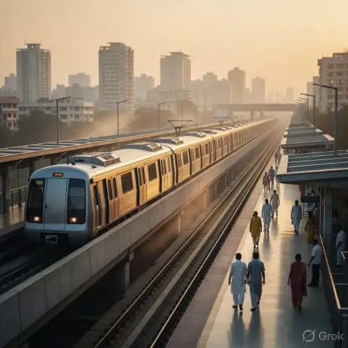
The new line is entirely elevated and will carry 12 stations. Embedded within it is a significant piece of civil engineering: a 6.93 km four-lane integrated flyover and an 8.69 km six-lane integrated flyover — meaning the project is simultaneously a metro rail corridor and a grade-separated road upgrade stacked on the same structure. Expected daily ridership is projected at 4,74,000 passengers, a number that signals the commuter pressure already building along this industrial belt.
The line is designed to directly serve the industrial and logistics hubs of Kalyan-Dombivli and Navi Mumbai — cities whose road networks groan under container traffic feeding the Jawaharlal Nehru Port corridor. Feeder bus services are proposed at every station, addressing the notorious 'last-mile gap' that undermines metro uptake across Indian cities.
Multi-modal junction at Katai Naka: Metro, highway, and bullet train converge
What makes Line 12-A architecturally significant in the MMR network is its interchange density. At Katai Naka, it will intersect with Metro Line 12 and — critically — the Mumbai–Ahmedabad Bullet Train corridor, making the station a rare three-mode junction. Between Katai Naka and Kalyan Phata, it will also link to Metro Line 14, and at Amandoot, it will connect to Navi Mumbai Metro Line 1. The net effect: a commuter in Taloja could, in principle, reach Bandra Kurla Complex or Mumbai airport without touching a road vehicle.
CM Fadnavis directed that the corridor be completed within three-and-a-half years and also instructed officials to accelerate the pace of all ongoing metro projects across the state to ensure timely delivery — a pointed signal that approvals alone are not the benchmark.
MMRDA as special planning authority: what the designation means
The committee simultaneously approved the Mumbai Metropolitan Region Development Authority (MMRDA) as the Special Planning Authority for both the metro line and the integrated flyovers. Beyond execution, MMRDA has also been authorised to receive government land parcels within the project's influence zone for transit-oriented development and fund mobilisation — a tool the authority has used before to cross-subsidise capital costs without burdening the state exchequer entirely.
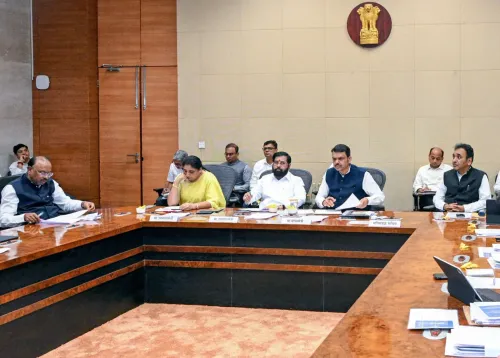
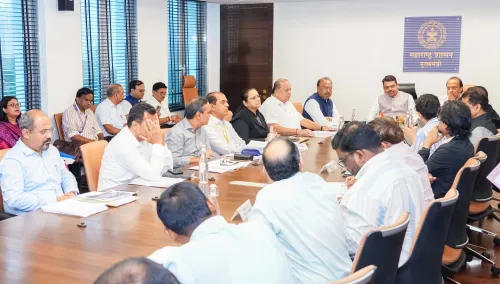
The meeting was attended by Deputy Chief Minister Eknath Shinde, Deputy Chief Minister Sunetra Ajit Pawar, Minister Chandrashekhar Bawankule, and senior officials from the state government.
Travel time, carbon, and the road-congestion dividend
The state projects that travel time along this corridor will fall by 40% to 50% compared with existing road journeys. A shift of hundreds of thousands of daily trips from private vehicles to rail is expected to reduce CO₂ emissions and ease density on the national highways that currently double as local arteries through Thane and Raigad districts. Maharashtra has consistently framed its metro expansion not just as a mobility upgrade but as a decarbonisation instrument — and the Line 12-A approval fits squarely in that framing.
The industrial belt between Dombivli and Taloja has long complained that world-class manufacturing clusters sit behind third-world road infrastructure. With a 3.5-year clock now officially ticking, that argument has an expiry date.
Point of View
Three other metro lines, and port-bound freight corridors. Granting MMRDA both Special Planning Authority status and land-transfer powers is a well-worn Maharashtra template for accelerating capital formation without solely depending on budgetary allocation, but the mechanism's success hinges on MMRDA's ability to execute cleanly within the 3.5-year window. CM Fadnavis's explicit instruction to speed up 'all ongoing metro works' signals political impatience with the yawning gap between approval and delivery that has plagued MMR infrastructure for years. If the corridor meets its deadline, it becomes a flagship argument in the state's 2029 electoral narrative; if it slips, it joins a long list of sanctioned-but-stalled corridors.
NationPress
28 Oct 2026
Frequently Asked Questions
What is Mumbai Metro Line 12-A and where does it go?
Mumbai Metro Line 12-A is an approved 18.40 km fully elevated metro corridor running from Manpada–Katai Naka to Taloja via Kalyan Phata. It will have 12 stations and serve the industrial and logistics zones of Kalyan-Dombivli and Navi Mumbai.
When will Mumbai Metro Line 12-A be completed?
CM Devendra Fadnavis has directed that the corridor be completed within three-and-a-half years of approval, which was granted on 27 October 2026.
Which metro lines and transport projects will connect to Line 12-A?
Line 12-A will connect to Metro Line 12 and the Mumbai–Ahmedabad Bullet Train at Katai Naka, Metro Line 14 between Katai Naka and Kalyan Phata, and Navi Mumbai Metro Line 1 at Amandoot.
What is MMRDA's role in the Metro Line 12-A project?
The Mumbai Metropolitan Region Development Authority (MMRDA) has been designated the implementing agency and Special Planning Authority for both the metro corridor and the integrated flyovers. It has also been authorised to receive government land within the project zone for development and fund mobilisation.
How much will Metro Line 12-A reduce travel time?
The state projects a 40% to 50% reduction in travel time compared with existing road journeys along the corridor, alongside reduced CO₂ emissions and lower traffic density on national highways.