CM Himanta Announces Hydro-Informatics Unit to Boost Assam Flood Forecasting

Synopsis
Assam Chief Minister Himanta Biswa Sarma has announced a Hydro-Informatics Unit to transform the state's flood forecasting by merging weather, water-depth and historical data. The move signals a shift from post-flood relief toward predictive, climate-adaptive disaster management in one of India's most flood-prone states.
Key Takeaways
CM Himanta Biswa Sarma announced the upcoming Hydro-Informatics Unit (HIU) for Assam on 4 July 2026 .
The HIU will integrate weather data, water depth readings and historical flood trends to improve forecasting accuracy.
The initiative is framed as a direct response to the growing challenges of climate change on the state's disaster response capacity.
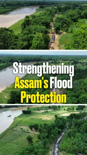
Assam faces annual flooding from the Brahmaputra and Barak river systems, affecting hundreds of thousands of residents each monsoon.
The announcement builds on institutional groundwork laid by the Assam State Disaster Management Authority (2007) and the National Disaster Management Plan 2016 .
Timeline, budget and integration with India Meteorological Department systems are yet to be officially announced.
Assam Chief Minister Himanta Biswa Sarma on Saturday, 4 July 2026, announced plans for a dedicated Hydro-Informatics Unit (HIU) aimed at strengthening the state's disaster response capabilities in the face of intensifying climate change. The unit is intended to converge multiple data streams — including weather patterns, water depth readings and historical flood trends — to deliver sharper flood forecasts for the chronically flood-prone state.
Context
Assam faces annual inundation driven by the Brahmaputra and Barak river systems, displacing hundreds of thousands of residents each monsoon season. CM Sarma posted on X, stating: 'We aim to raise our disaster response to meet the challenges of climate changes. The upcoming Hydro-Informatics Unit (HIU) will result in better flood forecasting by converging data points of various metrics such as weather, water depth, past trends among others.' The post tagged @borgohainSBG, indicating a direct communication with a state official or stakeholder involved in the initiative.
Policy Backdrop
The HIU announcement builds on a long chain of institutional efforts to modernise flood management in the Northeast. The Assam State Disaster Management Authority, formed in 2007, laid the groundwork for coordinated early-warning infrastructure, while the National Disaster Management Plan 2016 specifically called for technology-driven, climate-adaptive forecasting in riverine states. Pilots using GIS-based hydrological monitoring were introduced in Assam through Brahmaputra Board and central water resources programmes during the 2010s, providing a technical foundation on which the HIU is expected to build.
The National Disaster Management Authority (NDMA), established in 2005, sets national guidelines for state-level disaster technology adoption. The HIU concept aligns with the NDMA's broader push for anticipatory governance — shifting state machinery from reactive relief operations toward predictive, data-led preparedness.
Stakeholders and Impact
The most direct beneficiaries of an operational HIU would be flood-prone communities across Assam's low-lying districts, where early and accurate flood warnings can mean the difference between timely evacuation and loss of life and livestock. State disaster management agencies would gain a consolidated data platform, reducing the lag between incoming hydrological signals and actionable alerts issued to district administrations.
The broader Northeast region, where multiple states share river basin dynamics, could also benefit if the HIU's data architecture is eventually integrated with central meteorological systems. The initiative reflects a wider pattern across Indian states of adopting remote-sensing, hydrological modelling and historical trend analysis to address monsoon flooding worsened by climate variability.
What's Next
Key details — including the HIU's operational timeline, budget allocation and planned integration with India Meteorological Department systems — remain to be officially disclosed. Observers will watch whether the unit becomes functional ahead of the 2027 monsoon season, which would serve as its first real-world stress test. If the HIU delivers on its stated mandate, it could serve as a replicable model for other flood-vulnerable states in the Northeast seeking to modernise their early-warning infrastructure.
Point of View
The Chief Minister is aligning state policy with the national shift toward anticipatory disaster governance rather than relief-centric responses. The move also carries political weight: demonstrating technological ambition in disaster management can blunt criticism of inadequate flood preparedness ahead of future electoral cycles. Whether the HIU translates from announcement to operational infrastructure will be the real measure of this initiative's significance.
NationPress
4 Jul 2026
Frequently Asked Questions
What is the Hydro-Informatics Unit (HIU) in Assam?
The Hydro-Informatics Unit is a planned Assam government body announced by Chief Minister Himanta Biswa Sarma to improve flood forecasting by integrating weather data, water depth measurements and historical flood trends into a single platform.
Why does Assam need better flood forecasting?
Assam is one of India's most flood-prone states, with the Brahmaputra and Barak river systems causing annual inundation that displaces large numbers of residents. Climate change is intensifying the frequency and severity of these floods, making early-warning systems increasingly critical.
How does the HIU relate to existing disaster management bodies in Assam?
The HIU builds on the foundation of the Assam State Disaster Management Authority, formed in 2007, and aligns with the National Disaster Management Plan 2016, which called for technology-driven flood forecasting in riverine states.
When will the Assam Hydro-Informatics Unit become operational?
An exact launch date has not been officially announced. Observers are watching whether the unit becomes functional before the 2027 monsoon season, which would serve as its first major test.
What data will the Hydro-Informatics Unit use for flood forecasting?
According to CM Sarma's announcement, the HIU will converge multiple data points including weather patterns, water depth readings and historical flood trends to generate improved flood forecasts.