CM Himanta Highlights ASSAC's 60+ Projects in Five Years

Synopsis
Assam Chief Minister Himanta Biswa Sarma has spotlighted the Assam State Space Application Centre's record of over 60 projects in five years, covering satellite mapping and forecasting to strengthen evidence-based governance in one of India's most flood-prone states.
Key Takeaways
ASSAC has undertaken over 60 projects in the last five years in Assam.
Work spans mapping, forecasting, and support for government decision-making and service delivery.
Assam faces chronic challenges including annual Brahmaputra flooding and riverbank erosion that geospatial tools help address.
NESAC , established in Shillong in 2000 , provides the regional institutional foundation for space technology in the Northeast.
CM Himanta Biswa Sarma framed ASSAC's work as a long-term, science-led approach to structural state problems.
Potential integration with National Disaster Management Authority frameworks could extend the impact of ASSAC's data.
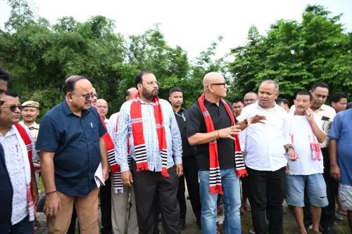
Assam Chief Minister Himanta Biswa Sarma on Friday, 3 July 2026, highlighted the state's growing use of satellite and geospatial technology, stating that the Assam State Space Application Centre (ASSAC) has completed over 60 projects in the past five years spanning mapping, forecasting, and government planning.
Context
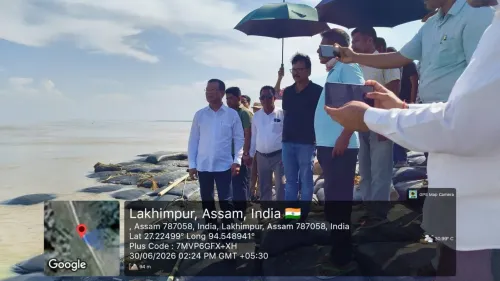
Assam is one of India's most flood-vulnerable states, with the Brahmaputra river system causing annual inundation, riverbank erosion, and agricultural disruption across large swathes of the state. The Chief Minister's post underscores a deliberate shift toward science-led governance, with ASSAC positioned as a central instrument for evidence-based decision-making and improved service delivery.
Sarma stated that 'Assam is leveraging science to find solutions to long term problems,' framing the centre's work as a structural response to chronic vulnerabilities rather than ad hoc crisis management.
Policy Backdrop
The use of space technology for state-level governance in India has roots going back to the establishment of the North Eastern Space Applications Centre (NESAC) in Shillong in 2000, a joint venture between ISRO and the Department of Space. NESAC was created specifically to extend satellite-based resource management and disaster support to northeastern states, including Assam.
Following ISRO guidance, several Indian states set up dedicated space application centres through the 2000s and 2010s to integrate remote sensing into flood forecasting, land-use planning, and agricultural monitoring. ASSAC operates within this broader national framework, channelling satellite data into Assam's state planning machinery.
India has progressively decentralised access to ISRO satellite data through such state centres, aiming to make geospatial intelligence a routine input for district-level administration and disaster preparedness rather than a specialised central resource.
Stakeholders and Impact
The primary beneficiaries of ASSAC's work are Assam's state planning departments, which rely on geospatial outputs for land records, infrastructure planning, and resource allocation. Flood-prone communities along the Brahmaputra and its tributaries stand to gain from improved early warning systems and more accurate flood inundation mapping.
Across 60-plus projects over five years, the centre's work spans multiple domains — from agricultural variability forecasting to erosion monitoring — giving government departments a data backbone for both routine decisions and emergency response. Comparable centres in other Indian states have demonstrated that consistent geospatial inputs can measurably improve the targeting of welfare schemes and infrastructure investment.
What's Next
Analysts and policy watchers will look for deeper integration of ASSAC outputs with central frameworks such as those operated by the National Disaster Management Authority, as well as updated state flood action plans that could draw on the centre's five-year data repository.
As Assam heads into successive monsoon seasons, the institutionalisation of space-based forecasting through ASSAC could serve as a model for other northeastern states seeking to embed scientific tools into routine governance, potentially strengthening the case for expanded funding and inter-agency collaboration under NEDA's regional coordination umbrella.
Point of View
Not merely an administrative detail. Embedding satellite data into routine state planning is consistent with a broader national push to make ISRO's capabilities accessible at the district level, reducing dependence on post-disaster response in favour of anticipatory governance. For a state where annual flooding displaces hundreds of thousands, institutionalising geospatial forecasting carries tangible political as well as administrative weight. The announcement also positions Assam as a potential template for other NEDA member states seeking to modernise their planning infrastructure.
NationPress
3 Jul 2026
Frequently Asked Questions
What is the Assam State Space Application Centre (ASSAC)?
ASSAC is a state-level agency in Assam that applies satellite remote sensing and GIS technology for mapping, forecasting, and government planning, helping state departments make evidence-based decisions.
How many projects has ASSAC completed?
According to CM Himanta Biswa Sarma, ASSAC has undertaken over 60 projects in the last five years across mapping and forecasting to support government decision-making and service delivery.
Why does Assam use satellite technology for governance?
Assam faces recurrent Brahmaputra floods, riverbank erosion, and agricultural variability; satellite and geospatial tools allow the state to forecast, map, and plan responses more accurately than traditional methods.
What is NESAC and how is it related to Assam?
The North Eastern Space Applications Centre (NESAC), established in Shillong in 2000 as an ISRO-Department of Space joint venture, provides the regional institutional backbone for satellite-based resource management and disaster support across northeastern states including Assam.
What could ASSAC's data be used for next?
Policy watchers expect ASSAC outputs to be integrated with National Disaster Management Authority frameworks and updated state flood action plans, potentially making Assam a model for space-technology-led governance in the Northeast.