How will experts transform urban land records with geospatial technologies?
Synopsis
Join us as experts from the Survey of India gather in New Delhi to discuss the revolutionary potential of geospatial technologies in urban land records. This national symposium aims to reshape land administration and enhance citizen services, marking a pivotal step toward a more transparent and efficient system.
Key Takeaways
Integrating geospatial technologies can revolutionize urban land records.
The symposium serves as a platform for collaboration among policymakers and experts .
Emerging technologies like AI/ML and 3D mapping are crucial for improving land governance.
The UrPro Card aims to provide secure digital property rights.
A 'Whole-of-Government' approach is vital for effective land administration.
New Delhi, Dec 2 (NationPress) Tomorrow, key decision-makers and specialists from the Survey of India will engage in discussions focused on hastening the integration of geospatial technologies aimed at revolutionizing urban land records during a national symposium in New Delhi, as stated by a representative from the Ministry of Rural Development.
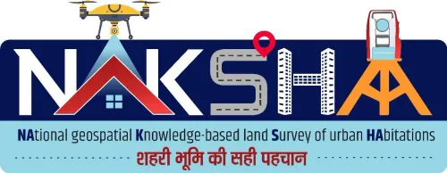
The Department of Land Resources (DoLR), under the Ministry of Rural Development, is set to organize the National Symposium on NAKSHA – National Geospatial Knowledge-based Land Survey of Urban Habitations and LandStack, as indicated in the official announcement.
This symposium serves as a dedicated forum within the GeoSmart India 2025 Conference and Expo, designed to promote the adoption of geospatial technologies for the advancement of urban land records and the improvement of citizen services nationwide.
Participants will include essential policymakers, domain experts from the Survey of India, State Revenue/Land Records officials, and industry leaders, all coming together for intensive discussions across six significant sessions, according to the statement.
The event will feature a thorough evaluation of the NAKSHA pilot program, which utilizes modern aerial technology and feature extraction methods for precise land mapping across more than 157 cities.
Topics for discussion will include technical obstacles, ensuring data accuracy in densely populated urban areas, and the alignment of aerial surveys with ground realities and existing cadastral maps, as noted in the statement.
Additionally, the symposium will hold dedicated sessions regarding the creation of the LandStack, envisioned as India's comprehensive digital land ecosystem. Experts will discuss foundational layers, the architectural challenges related to integrating cadastral maps, geospatial data, and administrative records, as well as the importance of federated models adhering to national standards for seamless data exchange.
A major highlight will be the UrPro Card, proposed as a singular, reliable digital property document.
"The discussions will explore the necessary legal and institutional adjustments required in States and Union Territories to effectively integrate the UrPro Card across various systems, including registration, mutation, property tax, and building permissions, thereby empowering citizens with secure and transferable digital property rights," said the statement.
The symposium will also showcase an end-to-end demonstration of the state-of-the-art WebGIS Platform and Cloud Services.
"The discussions will emphasize leveraging emerging technologies such as AI/ML analytics, 3D mapping, and cloud-based geospatial services to enhance transparency, accuracy, and accountability in urban land governance, thus improving the quality of life for citizens," stated the announcement.
This event highlights the government's dedication to employing advanced technology and a 'Whole-of-Government' approach to replace outdated systems with transparent, citizen-focused digital land administration, which is essential for realizing the vision of Viksit Bharat, as stated.
Point of View
This symposium represents a significant shift towards modernizing urban land records through advanced technologies. The collaboration between policymakers and experts is crucial for ensuring that the digital transformation aligns with citizen needs and enhances transparency in land governance. Emphasizing a 'Whole-of-Government' approach, this initiative underscores the commitment to making governance more efficient and citizen-centric.
NationPress
25 Jun 2026
Frequently Asked Questions
What is the purpose of the NAKSHA symposium?
The NAKSHA symposium aims to accelerate the adoption of geospatial technologies to revolutionize urban land records and improve citizen services across India.
Who will participate in the symposium?
Key policymakers, domain experts from the Survey of India, State Revenue/Land Records officials, and industry leaders will participate in the symposium.
What technologies will be discussed?
The symposium will focus on technologies such as AI/ML analytics, 3D mapping, and cloud geospatial services.
What is the UrPro Card?
The UrPro Card is a proposed single, trusted digital property document aimed at streamlining property rights for citizens.
How will the event impact urban governance?
The discussions will address challenges in urban land governance and propose solutions to enhance transparency, accuracy, and citizen empowerment.