Heavy rain to lash south Bengal for 24 hours as low pressure shifts to Jharkhand

Synopsis
A Bay of Bengal low-pressure system is tracking into Jharkhand and Bihar — but it is leaving behind a 24-hour heavy rain window for south Bengal. Six districts face 70–100 mm of rainfall, Monday's deluge already pushed Asansol past 157 mm, and north Bengal is on alert through Wednesday. The system's tail is proving as damaging as its core.
Key Takeaways
The IMD has issued a heavy rain warning for south Bengal for 24 hours from 18 August .
Six districts — West Midnapore, Jhargram, Purulia, Bankura, West Burdwan , and Birbhum — may receive 70–100 mm of rain on Tuesday.
The low-pressure system is 100 km from Ranchi and moving at 10 km/h toward Bihar and Jharkhand.
On Monday, 17 August , Asansol recorded 157.5 mm , Siuri 114.8 mm , and Midnapore town 109.6 mm of rainfall.
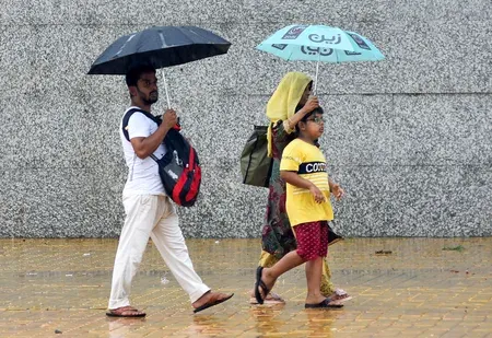
Kolkata faces light to moderate scattered rain on Tuesday after Monday's waterlogging disrupted traffic citywide.
Heavy rain alerts also cover Darjeeling, Jalpaiguri, Kalimpong , and Alipurduar in north Bengal through Wednesday .
Heavy rainfall is set to continue across south Bengal districts for the next 24 hours, the India Meteorological Department (IMD) said on Tuesday, 18 August, even as the low-pressure area that triggered the deluge begins its westward march toward Jharkhand and Bihar. The system, originally formed over the Bay of Bengal, is currently positioned north of Gangetic West Bengal and is tracking at 10 kilometres per hour.
Where the System Stands Now
As of Tuesday morning, the low-pressure area was located approximately 100 kilometres from Ranchi, 160 kilometres southeast of Gaya in Bihar, and 210 kilometres east of Daltonganj in Jharkhand. Meteorologists say it will move west-northwest into Bihar within the next 24 hours. Crucially, because portions of the system still overlap with Gangetic West Bengal, the threat of thunderstorms across south Bengal persists through Tuesday.
Districts Under Heavy Rain Warning
The IMD has issued a heavy rain warning for West Midnapore, Jhargram, Purulia, Bankura, West Burdwan, and Birbhum districts, which may receive between 70 and 100 millimetres of rainfall on Tuesday. Accompanying storms with wind speeds of 30 to 40 kilometres per hour are also possible in some of these areas. The remaining south Bengal districts, while not under a formal warning, are expected to see scattered showers.
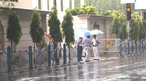
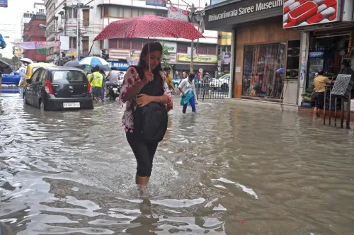
For Kolkata specifically, the forecast is lighter than Monday's downpour — light to moderate scattered rain is expected through the day. On Monday, 17 August, the city recorded sustained heavy rainfall that waterlogged several neighbourhoods and severely disrupted traffic movement.
Monday's Rainfall Record
The scale of Monday's event is evident in station-level data: Asansol recorded 157.5 mm of rain, Siuri logged 114.8 mm, and Midnapore town received 109.6 mm — all exceeding the 100 mm threshold that classifies an event as extremely heavy rainfall. Every district in south Bengal, including Kolkata, reported rain throughout the day.
North Bengal Also on Alert
The weather warning extends to north Bengal as well. A heavy rain alert has been issued for Darjeeling, Jalpaiguri, Kalimpong, and Alipurduar districts for both Tuesday and Wednesday. The remaining north Bengal districts are forecast to receive light to moderate rainfall over the same period.
With the low-pressure system expected to weaken as it moves further inland, conditions in Bengal are likely to ease by mid-week — though residents in the warned districts should remain on alert through Wednesday.
Point of View
But the Kolkata waterlogging on Monday exposed the city's chronic drainage deficit, which no weather forecast can fix. With climate patterns intensifying Bay of Bengal systems, Bengal's urban infrastructure faces a stress test that recurs every monsoon — and the response remains reactive rather than structural.
NationPress
18 Aug 2026
Frequently Asked Questions
Why is south Bengal still getting heavy rain even though the low-pressure system is moving away?
Because portions of the low-pressure system still overlap with Gangetic West Bengal even as its centre tracks toward Jharkhand and Bihar, the IMD says thunderstorms and heavy rain remain possible across south Bengal on Tuesday. The system's full exit from the region is expected within 24 hours.
Which districts in south Bengal are under a heavy rain warning on 18 August?
The IMD has issued a heavy rain warning for West Midnapore, Jhargram, Purulia, Bankura, West Burdwan, and Birbhum districts, with expected rainfall of 70–100 mm. Accompanying storms with wind speeds of 30–40 km/h are also possible in some of these areas.
How much rain did south Bengal receive on Monday, 17 August?
Asansol recorded 157.5 mm, Siuri 114.8 mm, and Midnapore town 109.6 mm of rainfall on Monday — all above the 100 mm threshold for extremely heavy rain. Every district in south Bengal, including Kolkata, reported rain throughout the day.
Will Kolkata face heavy rain again on Tuesday?
The IMD has not issued a heavy rain warning for Kolkata on Tuesday, forecasting only light to moderate scattered rain through the day. However, Monday's sustained downpour left several city areas waterlogged and disrupted traffic, and some residual wet conditions are expected.
Is north Bengal also affected by the current weather system?
Yes. The IMD has issued a heavy rain warning for Darjeeling, Jalpaiguri, Kalimpong, and Alipurduar for both Tuesday and Wednesday. The remaining north Bengal districts are forecast to receive light to moderate rainfall over the same period.