Himalayan disasters: Chamoli 2021 to Nepal deluge, a pattern of peril
Synopsis
From Uttarakhand's Chamoli in 2021 to Nepal's latest deluge and a GLOF in Gilgit-Baltistan last week, the Hindu Kush Himalaya region is signalling a systemic breakdown — not a string of bad luck. Experts say glacial melt, reckless infrastructure, and the absence of cross-border early warning systems are turning geological fragility into recurring mass casualties.
Key Takeaways
The Nepal deluge has displaced thousands and claimed hundreds of lives, with floodwaters threatening India's Indo-Gangetic plains .
The Chamoli flash flood of February 2021 in Uttarakhand killed over 200 people after a chunk of the Nanda Devi glacier collapsed, destroying two dams and damaging the Reni village hydropower project.
A GLOF in Gilgit-Baltistan, Pakistan last week damaged more than 100 houses and blocked the Ghizer River .
Experts link recurring disasters to climate change , thawing permafrost, and uncoordinated infrastructure development in ecologically fragile zones.
An eight-nation intergovernmental initiative — covering Afghanistan, Bangladesh, Bhutan, China, India, Myanmar, Nepal, and Pakistan — has been launched to build unified real-time early warning systems.
Scientists call for 'climate-smart' planning and a halt to large hydropower and highway projects in sensitive HKH terrain.
The recent Nepal deluge has once again laid bare the deep vulnerability of the Hindu Kush Himalaya (HKH) region, where destabilised glaciers, thawing permafrost, and erratic monsoon patterns combine to send torrents of water, mud, and debris cascading through densely populated valleys. Experts warn this is not an isolated weather event but a symptom of accelerating ecological instability across the subcontinent.
Nepal Deluge: Scale of Destruction
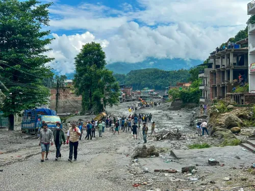
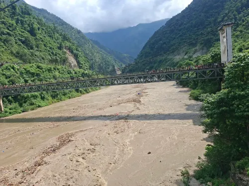
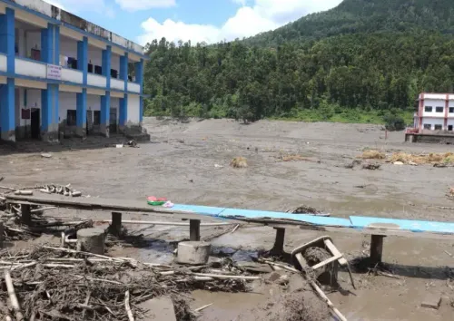
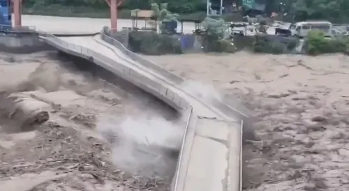
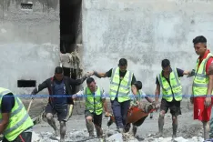
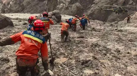
The flooding in Nepal, though appearing localised in initial reports, swallowed entire buildings and bridges, displaced thousands of residents, and claimed hundreds of lives. Analysts note that rivers swollen by the deluge flow directly into India's Indo-Gangetic plains, extending the ecological threat well beyond Nepal's borders. The disaster has reignited calls for cross-border early warning infrastructure across the HKH region.
The Chamoli Disaster of February 2021: A Stark Precedent
Experts and researchers have repeatedly drawn structural parallels between the Nepal flooding and the catastrophic Chamoli flash flood of February 2021 in Uttarakhand. In that incident, a massive chunk of rock and ice broke away from the Nanda Devi glacier, triggering an avalanche that sent a cascading wall of water into the Rishiganga and Dhauliganga rivers. Two dams were destroyed, the hydropower project at Reni village was severely damaged, hundreds of workers were trapped in downstream tunnels, and water levels on the Alaknanda surged. According to reports, the disaster claimed over 200 lives.
The Chamoli tragedy served as a stark warning: the Himalayas are structurally weakening under the dual pressure of climate change and aggressive, often uncoordinated infrastructure development. Thawing permafrost and accelerating glacial melt had compromised the mountainside's integrity long before the collapse.
Shared Geology, Shared Risk
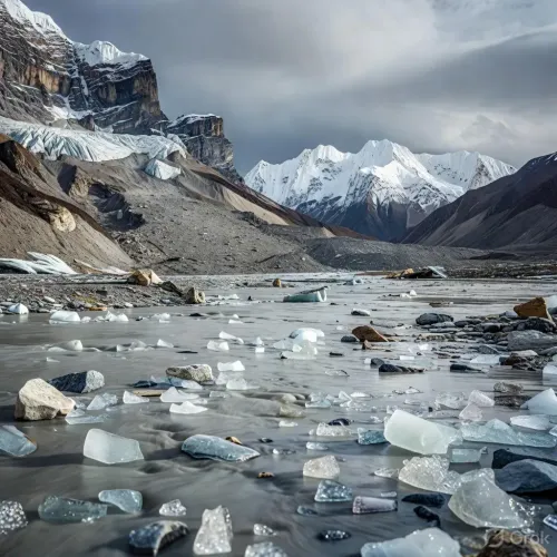
Both Nepal and Uttarakhand lie within one of the youngest yet most tectonically active mountain ranges on Earth, where fragility is compounded by rising global temperatures. In Nepal's case, warmer atmospheric conditions and construction activity near the China border have reportedly altered local climatic patterns, producing hyper-localised cloudbursts. Such extremes destabilise terrain and trigger debris flows comparable to glacial lake outburst floods (GLOFs).
Notably, a GLOF in Pakistan's Gilgit-Baltistan last week damaged more than 100 houses and blocked the Ghizer River, as a sudden release of water from a glacial lake swept through downstream villages — underscoring that the crisis is regional, not bilateral.
Infrastructure and the Multiplier Effect
Reports highlight that large dams and roads carved into fragile hillsides without rigorous environmental assessment are turning manageable geological anomalies into lethal disasters. Critics argue that the absence of coordinated regional planning multiplies hazard risk across the HKH corridor, which spans Afghanistan, Bangladesh, Bhutan, China, India, Myanmar, Nepal, and Pakistan.
An intergovernmental initiative involving all eight countries has been initiated to unify real-time data-sharing networks for cross-border early warning systems. Experts stress the urgency of automated alerts whenever a glacial lake breaches or a landslide blocks an upstream river, and call for 'climate-smart' infrastructure planning that halts massive hydropower and highway projects in ecologically sensitive zones.
What Needs to Happen Next
The recurrence of Himalayan disasters — from Chamoli to Gilgit-Baltistan to the latest Nepal deluge — underscores a sobering reality: the mountains are changing faster than human systems are adapting. Scientists and policy experts argue that only sustained regional solidarity, backed by binding early warning protocols and a moratorium on high-risk infrastructure, can prevent the next catastrophe.
Point of View
In fact, a governance and geopolitics story. The Hindu Kush Himalaya corridor has now produced cascading disasters across at least three countries within weeks — yet the eight-nation early warning initiative remains at the data-sharing stage, not the automated-alert stage. The Chamoli disaster of 2021 offered a precise blueprint of what uncoordinated infrastructure in glacially active terrain produces; three years on, the blueprint has not been acted upon. The harder question mainstream coverage avoids is this: which governments are still approving hydropower and highway projects in red-zone terrain, and what is the legal accountability when those projects amplify a natural disaster into a mass casualty event?
NationPress
29 Aug 2026
Frequently Asked Questions
What caused the Chamoli disaster in February 2021?
The Chamoli disaster was triggered when a massive chunk of rock and ice broke off the Nanda Devi glacier in Uttarakhand, sending a wall of water into the Rishiganga and Dhauliganga rivers. Two dams were destroyed, the Reni village hydropower project was damaged, and over 200 people were killed.
How is the Nepal deluge connected to the Chamoli disaster?
Experts draw structural links between the two events based on shared geology and climate conditions — both regions lie within the tectonically active Hindu Kush Himalaya range, where glacial melt, thawing permafrost, and unplanned infrastructure amplify natural hazards into large-scale disasters.
What is a glacial lake outburst flood (GLOF) and why does it matter?
A GLOF occurs when water held back by a glacial moraine or ice dam is suddenly released, sending a destructive surge downstream. A GLOF in Pakistan's Gilgit-Baltistan last week damaged over 100 houses and blocked the Ghizer River, illustrating the regional scale of the threat.
Which countries are involved in the Himalayan early warning initiative?
An intergovernmental effort involving Afghanistan, Bangladesh, Bhutan, China, India, Myanmar, Nepal, and Pakistan has been initiated to build unified real-time data-sharing networks for cross-border early warning systems covering glacial and flood hazards.
What do experts recommend to prevent future Himalayan disasters?
Experts call for automated cross-border alerts when glacial lakes breach or landslides block upstream rivers, along with 'climate-smart' infrastructure planning that halts large hydropower and highway projects in ecologically sensitive HKH zones.