Ukai-Kakrapar Project: South Gujarat's 75-year water lifeline explained
Synopsis
Built before Gujarat was even a state, the Ukai-Kakrapar Multipurpose Project has spent over 75 years quietly powering, irrigating, and hydrating South Gujarat. With a 7,497 MCM reservoir, links to a 1,840 MW atomic station, and farmland across five districts, it is arguably the most consequential piece of infrastructure most people outside the region have never heard of.
Key Takeaways
The Ukai-Kakrapar Multipurpose Project was initiated in 1949 , predating Gujarat's formation in 1960.
The reservoir holds up to 7,497 MCM of water, with 6,615 MCM of live storage, spanning about 600 sq km .
The project irrigates 3,31,557 hectares across Bharuch, Surat, Navsari, Tapi , and Valsad districts.
It supports the 1,110 MW Ukai Thermal Plant , 305 MW Ukai Hydropower Plant , and 1,840 MW Kakrapar Atomic Power Station .
Lift irrigation schemes serve 298 villages across Tapi, Surat, and Narmada districts.
The project operates under the guidance of Chief Minister Bhupendra Patel and MoS Ishwarsinh Patel .
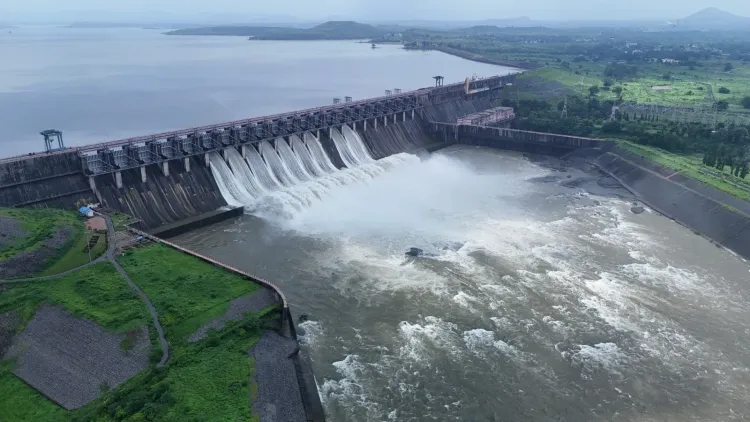
The Ukai-Kakrapar Multipurpose Project, whose foundations were laid in 1949 — before Gujarat even existed as a state — continues to anchor the water, power, and agricultural economy of South Gujarat more than seven decades on. The reservoir holds up to 7,497 million cubic metres (MCM) of water, making it the state's second-largest and oldest major multipurpose project.
Origins and Construction Timeline
The project was built in two distinct phases. The first began with the 633.50-metre-long Kakrapar Weir, constructed between 1949 and 1954, predating Gujarat's formation in 1960. The second phase followed after the Planning Commission approved the Ukai Dam project in August 1961 and the state government gave its formal nod in February 1962.
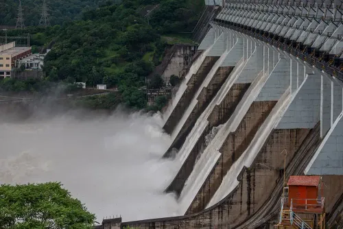
Construction of the Ukai Dam was completed in 1972, with the reservoir filled for the first time in 1973. The dam is situated at Ukai village in Songadh taluka of Tapi district, on the Tapi River.
Scale and Storage Capacity
The reservoir spans approximately 600 square kilometres, stretching about 112 km upstream of the dam with an average width of around 5.5 km. At full reservoir level, its perimeter reaches roughly 525 km. Of the total 7,497 MCM storage capacity, 6,615 MCM is classified as live storage. The catchment area upstream covers 62,225 square kilometres.
Irrigation and Drinking Water Reach
The project provides irrigation benefits across 3,31,557 hectares in Bharuch, Surat, Navsari, Tapi, and Valsad districts. Lift irrigation schemes — including the Ukai-Purna High-Level Canal, Songadh-Uchhal-Nizar, Kakrapar-Gordha-Vad, and Tapi-Karjan — serve thousands of hectares across 298 villages in Tapi, Surat, and Narmada districts. The Ukai-Purna High-Level Canal alone is 51,110 metres long with a carrying capacity of 480 cusecs.
Drinking water from the project reaches municipal corporations, municipalities, and water supply schemes across Bharuch, Surat, Navsari, and Valsad districts. Industrial users including GIDC units, J.K. Paper Mill, and sugar factories also draw water from the system.
Power Generation Links
The project is integral to Gujarat's energy infrastructure. Water from the Ukai-Kakrapar system supports the 1,110 MW Ukai Thermal Power Plant, the 305 MW Ukai Hydropower Plant, and the 1,840 MW Kakrapar Atomic Power Station — a combined installed capacity that underscores the project's outsized role in the state's power grid.
Flood Control and the Tapi River
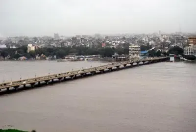
The Tapi River, on which the project is built, originates at Multai in Betul district of Madhya Pradesh and flows for 724 km, including 214 km through Gujarat. It is Gujarat's second-largest west-flowing river. Water storage during the monsoon is regulated according to prescribed levels in the project's operating manual, enabling the reservoir to balance storage, irrigation release, and flood management simultaneously.
Officials noted that the project continues to operate under the guidance of Chief Minister Bhupendra Patel and Minister of State for Water Resources and Water Supply Ishwarsinh Patel. With infrastructure predating the state itself, the Ukai-Kakrapar system remains a foundational pillar of South Gujarat's agricultural, urban, industrial, and energy needs — and its relevance shows no sign of diminishing.
Point of View
But it also raises questions that official accounts rarely surface. Infrastructure built in the 1950s and 1960s was designed for a Gujarat with a fraction of today's population and industrial load. The project now simultaneously serves irrigation, atomic cooling, thermal power, municipal drinking water, and industrial demand — functions that increasingly compete with one another, especially during low-monsoon years. The state's framing of the project as a success story is fair, but the harder question is whether a 75-year-old system, however well-maintained, can absorb the water-stress pressures of the next 25 years without structural augmentation.
NationPress
24 Sept 2026
Frequently Asked Questions
What is the Ukai-Kakrapar Multipurpose Project?
The Ukai-Kakrapar Multipurpose Project is Gujarat's second-largest and oldest major multipurpose water project, located on the Tapi River in Tapi district. Built in two phases between 1949 and 1972, it provides irrigation, drinking water, flood control, and power generation support across South Gujarat.
How much water can the Ukai reservoir store?
The Ukai reservoir has a total storage capacity of 7,497 MCM, of which 6,615 MCM is live storage. The reservoir covers approximately 600 square kilometres and extends about 112 km upstream of the dam.
Which power plants depend on the Ukai-Kakrapar project?
The project supports three major power facilities: the 1,110 MW Ukai Thermal Power Plant, the 305 MW Ukai Hydropower Plant, and the 1,840 MW Kakrapar Atomic Power Station, making it critical to Gujarat's energy supply.
Which districts benefit from the project's irrigation network?
The project provides irrigation to 3,31,557 hectares across Bharuch, Surat, Navsari, Tapi, and Valsad districts. Lift irrigation schemes additionally serve 298 villages in Tapi, Surat, and Narmada districts.
Was the Ukai-Kakrapar project built before Gujarat became a state?
Yes. The first phase — construction of the Kakrapar Weir — began in 1949 and was completed in 1954, six years before Gujarat was carved out as a separate state in 1960. The Ukai Dam itself was completed in 1972.