Chinese Academy of Sciences satellite data disputes US-Iran war damage claims
Synopsis
Chinese Academy of Sciences researchers say satellite imagery shows US military bases in the Middle East suffered more damage than Washington admitted — while also finding that Iran overstated its strike impact, challenging both sides' official war narratives in a peer-reviewed journal.
Key Takeaways
Chinese Academy of Sciences (CAS) researchers published satellite-based damage assessments of US military bases in the Middle East in the journal The Innovation on July 7, 2026 .
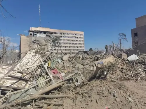
The study found that physical damage at bases including Ali Al Salem Air Base, Kuwait and Al Dhafra Air Base, UAE exceeded the ‘minimal damage’ characterisation in US briefings.
Researchers simultaneously concluded that Iranian claims of ‘massive strikes’ were likely overstated, challenging both sides’ official narratives.
The US imposed ‘shutter control’ on commercial providers including Planet Labs on April 4 , cutting off high-resolution imagery over conflict zones.
The armed conflict began after American and Israeli air strikes on Iran on February 28, 2026 , and has since caused regional economic disruption and global instability.
Chinese Academy of Sciences (CAS) researchers have used advanced satellite imagery analysis to challenge official narratives from both Washington and Tehran about the scale of damage sustained during the US-Iran armed conflict that erupted following American and Israeli air strikes on Iran on February 28. The findings, published in the peer-reviewed journal The Innovation on July 7, expose significant discrepancies between what governments have publicly stated and what remote sensing data reveals on the ground.
What the satellite data found
Applying advanced remote sensing and image-processing techniques, the CAS scientists examined damage at US military installations across the Middle East, including Ali Al Salem Air Base in Kuwait and Al Dhafra Air Base in the United Arab Emirates. Their analysis identified damage patterns that point to operational shortcomings on both sides and exposed structural vulnerabilities in fixed overseas military installations.
'The observed scale of destruction indicates physical impacts that exceed the characterisations of ‘minimal damage’ or ‘successful defence’ commonly presented in US briefings,' the scientists wrote. They added that Iranian claims of ‘massive strikes’ may equally be overstated, suggesting both parties have shaped battlefield narratives to suit domestic audiences.
Why it matters
The study represents one of the first independent, open-source assessments of physical damage to US Naval Forces Central Command infrastructure during the conflict, drawing on commercial satellite data before access was restricted. The findings carry weight precisely because they originate from a state-affiliated institution in China — a country with strategic interests in the region — yet the conclusions cut against both American and Iranian official positions.
The research was conducted under the auspices of the Chinese Society for Surveying and Mapping, lending it additional institutional credibility within the geospatial science community.
The information blackout
On April 4, the US government enacted ‘shutter control’ measures targeting several commercial satellite imagery providers, including California-based Planet Labs, suspending the distribution of high-resolution space imagery over active conflict zones. The move effectively curtailed independent verification of battlefield conditions for much of the escalation phase of the conflict.
The CAS analysis appears to have drawn on imagery captured before those restrictions took effect, underscoring how brief the window for open-source intelligence was before it was closed by regulatory intervention.
Competitive backdrop
The publication highlights the growing role of non-Western scientific institutions in conflict monitoring — an area historically dominated by US-aligned research bodies and commercial providers. China’s own constellation of remote sensing satellites, expanding rapidly over the past decade, gives its researchers independent access to imagery that does not depend on American commercial providers subject to shutter control.
The armed conflict has already triggered economic disruption and global instability, with the Strait of Hormuz blockade affecting oil tanker movements and energy markets worldwide.
What’s next
With US shutter control measures still in place over conflict zones, independent verification of ongoing damage will remain constrained for Western-aligned researchers. The degree to which Chinese satellite data fills that gap — and how it is received by the international scientific and policy community — will be a key dynamic to watch as the conflict continues to evolve.
Point of View
Positioning itself as a neutral arbiter while quietly advertising the reach of its own space-based surveillance assets. The US shutter control order on Planet Labs and peers was designed to deny adversaries battlefield intelligence, but it also inadvertently created an information vacuum that non-Western actors with independent satellite constellations are now filling. Mainstream coverage has focused on the kinetic conflict; the quieter story is the accelerating fragmentation of the global remote sensing market into aligned and non-aligned blocs. Researchers and policymakers in the Global South will increasingly turn to Chinese satellite data when US-controlled commercial imagery is restricted — a structural shift with long-term consequences for how wars are documented and judged.
NationPress
13 Sept 2026
Frequently Asked Questions
What did the Chinese Academy of Sciences find in its satellite analysis of the US-Iran conflict?
The Chinese Academy of Sciences found that damage to US military bases in the Middle East exceeded what Washington described as ‘minimal damage,’ while also concluding that Iranian claims of ‘massive strikes’ were likely overstated. The findings were published in the peer-reviewed journal The Innovation on July 7, 2026 .
Which US military bases were assessed in the satellite imagery study?
Ali Al Salem Air Base in Kuwait and Al Dhafra Air Base in the United Arab Emirates were among the installations examined. Researchers used advanced remote sensing and image-processing techniques to identify damage patterns and operational vulnerabilities.
What is shutter control and why did the US impose it on Planet Labs?
Shutter control is a legal mechanism that allows the US government to order commercial satellite operators to stop distributing high-resolution imagery over designated areas. On April 4, 2026 , the US imposed these measures on providers including California -based Planet Labs to restrict independent monitoring of active conflict zones in the Middle East .
When did the US-Iran armed conflict begin?
American and Israeli air strikes against Iran launched on February 28, 2026 triggered the armed conflict. The fighting has since escalated across the region, causing economic disruption and contributing to global instability, including disruption to oil tanker movements through the Strait of Hormuz .
Why is a Chinese institution publishing assessments of US military base damage significant?
It signals that China — through institutions like the CAS and the Chinese Society for Surveying and Mapping — is positioning itself as an independent arbiter of conflict data at a time when US -aligned commercial satellite imagery has been restricted. With China’s own satellite constellation expanding, its researchers can access imagery independently of providers subject to American shutter control orders.