

Cyclone Akvan to hit Andhra coast on Nov 20, south Bengal rains from Thursday
Synopsis
Cyclone Akvan — the third Bay of Bengal cyclonic system in just three weeks — is on course to slam the Andhra Pradesh coast near Nellore with winds up to 145 kmph on November 20. South Bengal, while outside the direct track, faces heavy rain from Thursday through Saturday as the storm's outer bands sweep northward. Fishermen have been advised to stay ashore through the 20th.
Key Takeaways
Cyclone Akvan is forecast to cross the Andhra Pradesh coast between Nellore and Tuni around noon on 20 November .
The storm may intensify into a very severe cyclonic storm on 19 November with wind speeds of up to 145 kmph .
South Bengal districts — including Kolkata , Howrah , and South 24 Parganas — will see rain and thunderstorms from Thursday through Saturday .
Andhra Pradesh , Tamil Nadu , Telangana , and coastal Odisha are directly in the storm's path.
Fishermen advised not to venture into the north-west Bay of Bengal from 17 to 20 November .
Akvan is the third cyclone to form in the Bay of Bengal in just 21 days .
Cyclone Akvan, the third cyclone to form in the Bay of Bengal in 21 days, is set to make landfall along the Andhra Pradesh coast between Nellore and Tuni around noon on 20 November, the India Meteorological Department (IMD) warned on Tuesday, 17 November. As an indirect consequence, south Bengal districts — including Kolkata, Howrah, and coastal zones — will begin experiencing rain and thunderstorms from Thursday, 19 November, continuing through Saturday.
How Cyclone Akvan Is Intensifying
The system is currently drawing large volumes of moisture from the sea and is gradually strengthening over the west-central Bay of Bengal. The IMD has forecast a strong likelihood of Akvan intensifying into a severe cyclonic storm by Tuesday evening, before escalating further into a very severe cyclonic storm on the morning of 19 November.
The storm is then expected to move north-westwards and strike the Andhra Pradesh coastline. At peak intensity, wind speeds may reach up to 145 kilometres per hour, according to the weather office forecast.
States Directly in the Cyclone's Path
The IMD has identified Andhra Pradesh, Tamil Nadu, and Telangana as the states most directly affected by Cyclone Akvan. Odisha's coastal areas are also expected to feel the impact. Authorities in these states have been placed on alert ahead of the anticipated landfall.
Notably, this is the third consecutive cyclonic system to emerge in the Bay of Bengal within just three weeks, an unusually active period for the northern Indian Ocean during the post-monsoon season.
District-Wise Rain Forecast for West Bengal
Although Bengal lies outside the direct landfall zone, the cyclone's outer circulation will trigger widespread rainfall. According to the IMD forecast:
Wednesday (18 November): Light rain with thunderstorms is expected at one or two places in South 24 Parganas, East Midnapore, West Midnapore, Kolkata, and Howrah. Remaining south Bengal districts will stay dry.
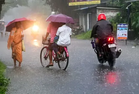
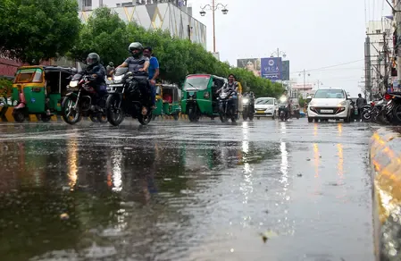
Thursday (19 November): Light to moderate rain with thundershowers likely at most places in North 24 Parganas, South 24 Parganas, East Midnapore, West Midnapore, Jhargram, Kolkata, and Howrah.
Friday (20 November): Light to moderate rain with thundershowers expected across most of the state. Heavy rain is specifically forecast for South 24 Parganas, East Midnapore, West Midnapore, and Jhargram.
Saturday (21 November): Light to moderate rain with thundershowers likely across most districts. Activity is expected to taper off by Sunday, with showers limited to a few places.
In north Bengal, light rain with thunderstorms is likely in Darjeeling, Kalimpong, Jalpaiguri, Cooch Behar, and Alipurduar during this period. The remaining north Bengal districts are expected to see dry conditions.
Fishermen Advisory and Current Conditions
The IMD has issued an advisory urging fishermen not to venture into the deep sea of the north-west Bay of Bengal adjacent to the west-central Bay of Bengal from 17 November through 20 November. No separate warning has been issued for fishermen along the West Bengal coast at this stage.
On Monday, 16 November, Kolkata and its surrounding areas recorded a maximum temperature of 29.2 degrees Celsius — 1.4 degrees below normal — and a minimum temperature of 22.2 degrees Celsius, which was 1.9 degrees above normal. Relative humidity ranged between 52% and 96%, reflecting the already moisture-laden atmosphere ahead of the approaching system.
With the storm set to intensify further over the next 48 hours, residents across south Bengal's coastal and low-lying districts should remain alert and monitor official advisories through the week.
Point of View
Much of which was last stress-tested during Cyclone Michaung in 2023. For Bengal, the indirect rain risk is real but manageable — the bigger story is the accelerating frequency of these systems and what it means for coastal resilience planning at both the state and national level.
NationPress
17 Nov 2026
Frequently Asked Questions
Where will Cyclone Akvan make landfall?
Cyclone Akvan is forecast to cross the Andhra Pradesh coastline between Nellore and Tuni around noon on 20 November 2026. It is expected to reach very severe cyclonic storm intensity by the morning of 19 November before making landfall.
What is the expected wind speed of Cyclone Akvan at landfall?
The IMD has forecast maximum wind speeds of up to 145 kilometres per hour when Cyclone Akvan crosses the Andhra Pradesh coast. The storm is currently intensifying over the west-central Bay of Bengal.
Which districts in West Bengal will be affected by Cyclone Akvan?
South Bengal districts will bear the indirect impact, with heavy rain forecast for South 24 Parganas, East Midnapore, West Midnapore, and Jhargram on Friday, 20 November. Kolkata, Howrah, and North 24 Parganas will also see light to moderate rain from Thursday through Saturday.
Is there a warning for fishermen in West Bengal?
The IMD has advised fishermen not to venture into the deep sea of the north-west Bay of Bengal adjacent to the west-central Bay of Bengal from 17 to 20 November. No separate coastal warning has been issued for the West Bengal shoreline at this stage.
Which states are most directly affected by Cyclone Akvan?
Andhra Pradesh, Tamil Nadu, and Telangana are identified as the states most directly in the cyclone's path. Coastal areas of Odisha are also expected to be affected, while West Bengal will experience indirect rainfall impact.