Rajasthan CMO: Geo-Tagged Saplings Watched by Van Mitra Volunteers
Synopsis
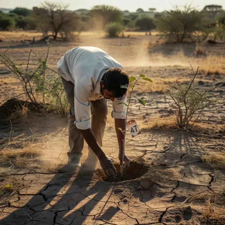
Rajasthan's CMO office says saplings planted under its afforestation campaign are being geo-tagged and assigned to Van Mitra and Vriksh Mitra community volunteers for continuous monitoring until each plant becomes a full-grown tree, addressing the state's chronic post-plantation survival challenge.
Key Takeaways
The Chief Minister's Office of Rajasthan announced on 2 August 2026 that saplings under its ongoing afforestation campaign are being geo-tagged for precise tracking.
Community volunteer networks — Van Mitra and Vriksh Mitra — are tasked with regular monitoring of each sapling until it matures into a tree.
Geo-tagging enables remote survival audits and location-specific accountability, addressing a long-standing weakness in large-scale plantation drives.
Rajasthan's arid and semi-arid geography makes post-plantation care especially critical, with heat, water scarcity, and grazing posing survival threats.
The initiative is tagged to Chief Minister Bhajanlal Sharma under the hashtag #आपणो_अग्रणी_राजस्थान ('Our Leading Rajasthan').
District-wise survival data from the Rajasthan forest department is expected to provide the first measurable test of the programme's effectiveness.
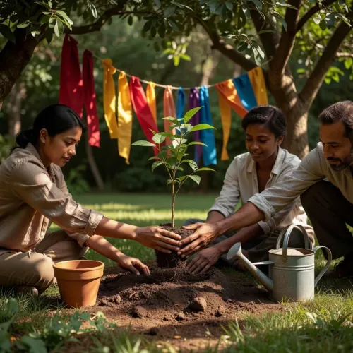
In the arid heartland of Rajasthan, where desertification is a lived reality and every surviving sapling counts, the state government is deploying a two-pronged strategy to ensure planted trees actually grow — geo-tagging each sapling and routing its care through a network of community volunteers called Van Mitra and Vriksh Mitra.
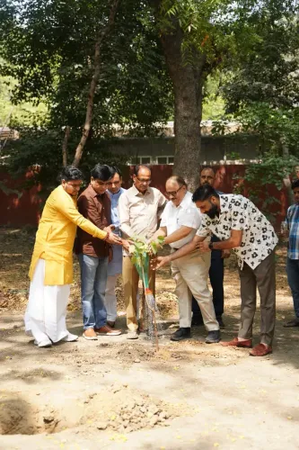
The Chief Minister's Office of Rajasthan announced on Sunday, 2 August 2026 that saplings planted under the ongoing afforestation campaign are being geo-tagged for precise location tracking, with regular monitoring assigned to Van Mitra and Vriksh Mitra volunteers until each plant matures into a full-grown tree. The post, tagged to Chief Minister Bhajanlal Sharma under the hashtag #आपणो_अग्रणी_राजस्थान ('Our Leading Rajasthan'), frames the initiative as a sustained commitment — not a one-season drive.
Why Geo-Tagging Changes the Survival Equation
India's afforestation programmes have long wrestled with a stubborn gap: saplings are planted in large numbers, but survival rates — especially in semi-arid zones — tell a harder story. Geo-tagging assigns each plant a fixed GPS coordinate, making it possible to audit survival remotely and hold local monitors accountable to a specific location, not just a vague patch of land.
Rajasthan, which carries a significant share of India's Thar Desert within its borders, has particular reason to invest in post-plantation care. Heat, scarce groundwater, and grazing pressure make the first two years after planting the most critical — and the most likely to be ignored once the cameras leave a plantation event.
Van Mitra and Vriksh Mitra: Volunteers as the Last Line of Care
The Van Mitra and Vriksh Mitra networks are community-based volunteer frameworks through which local residents — often from rural areas near plantation sites — take ownership of individual saplings. By routing monitoring through these networks, the government embeds accountability at the village level rather than relying solely on the forest department's stretched field staff.
This model mirrors a broader trend in Indian state-level green initiatives: pairing low-cost digital tools (geo-tags, mobile reporting) with on-ground human networks to stretch limited departmental capacity. The Rajasthan forest department is expected to release district-wise survival data in the coming months, which will offer the first hard test of how well the system is working.
For a state that has run plantation drives across multiple governments and multiple decades, the real measure of आपणो अग्रणी राजस्थान will not be the count of saplings planted — it will be the count still standing.
Point of View
The government shifts the metric from 'trees planted' to 'trees alive,' which is a meaningful governance upgrade. The initiative also fits Chief Minister Bhajanlal Sharma's pattern of branding state schemes under the 'Aapno Agrani Rajasthan' umbrella, linking environmental action to a wider political identity. The real credibility test arrives when the forest department publishes survival statistics — that data will determine whether this is durable policy or well-photographed intent.
NationPress
16 Sept 2026
Frequently Asked Questions
What is Van Mitra and Vriksh Mitra in Rajasthan?
Van Mitra and Vriksh Mitra are community-based volunteer networks in Rajasthan through which local residents monitor and care for saplings planted under the state's afforestation campaigns until the plants mature into trees.
Why is Rajasthan geo-tagging its planted saplings?
Geo-tagging assigns each sapling a GPS coordinate so the government can remotely audit survival rates and hold local monitors accountable to a specific location, improving transparency in afforestation drives.
What is the Aapno Agrani Rajasthan campaign?
'Aapno Agrani Rajasthan' — meaning 'Our Leading Rajasthan' — is a branding umbrella used by the Bhajanlal Sharma government to highlight state development and environmental initiatives.
How does Rajasthan plan to ensure planted trees survive?
The state is combining geo-tagging of each sapling with continuous on-ground monitoring by Van Mitra and Vriksh Mitra volunteers, targeting the critical first years when saplings are most vulnerable to heat, water scarcity, and grazing.
Who is Bhajanlal Sharma?
Bhajanlal Sharma is the Chief Minister of Rajasthan, in office since December 2023, and a BJP leader under whose tenure the state's current afforestation and environmental monitoring initiatives are being implemented.