Sri Lanka delegation visits India to study land governance reforms and DILRMP
Synopsis
India opened its land governance playbook to a Sri Lankan delegation, showcasing the Bharat Land Stack, ULPIN (Bhu-Aadhaar), paperless registration, and the DILRMP — a suite of reforms that has digitised millions of land records. The visit signals India's growing role as a regional model for technology-driven public administration reform.
Key Takeaways
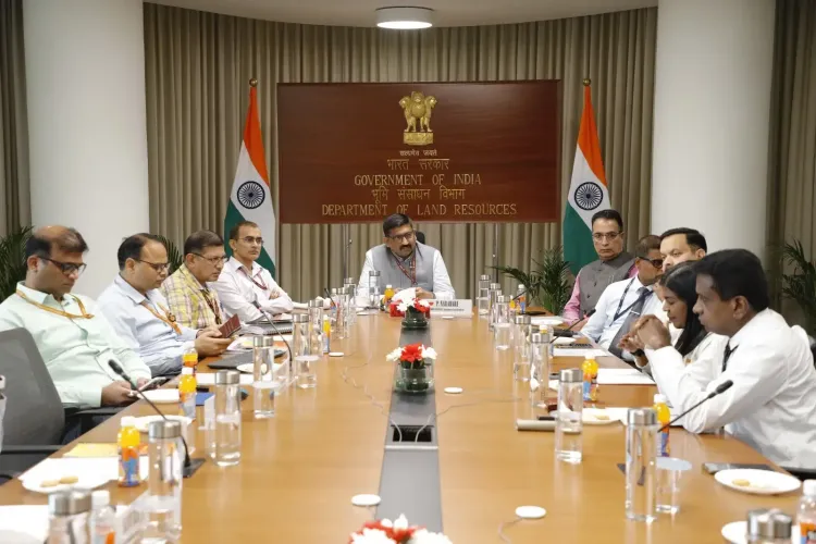
A Sri Lankan civil servants' delegation visited New Delhi on 23 September 2026 to study India's land governance reform experience.
The visit was hosted by the Department of Land Resources (DoLR) and coordinated by the National Centre for Good Governance (NCGG) .
India's Digital India Land Records Modernisation Programme (DILRMP) , Bharat Land Stack , and ULPIN (Bhu-Aadhaar) were key systems demonstrated.
ULPIN assigns a 14-digit alphanumeric identity to land parcels based on geospatial coordinates, linking them with multiple land-related datasets.
Reforms towards paperless registration and automated mutation were highlighted, enabling electronic transmission of registration data to revenue authorities.
NAKSHA was presented as India's initiative to advance urban land governance through modern geospatial technologies.
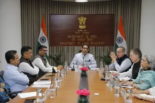
A Sri Lankan delegation of civil servants visited New Delhi on 23 September 2026 to study India's large-scale land governance reforms, covering digitisation of land records, spatial-textual integration, digital registration, geospatial identification of land parcels, computerisation of Revenue Courts, and modern urban land mapping, according to an official statement. The exposure programme was coordinated by the National Centre for Good Governance (NCGG) and hosted by the Department of Land Resources (DoLR) under the Ministry of Rural Development.
Key Reforms Showcased
The session placed particular emphasis on India's Digital India Land Records Modernisation Programme (DILRMP), the computerisation of Records of Rights (RoRs), integration of property registration with land records, and the Unique Land Parcel Identification Number (ULPIN) — also known as Bhu-Aadhaar. ULPIN assigns a unique 14-digit alphanumeric identity to land parcels based on their geospatial coordinates, enabling linkage with other land-related datasets and maintaining those linkages even when parcels are subdivided.
What Indian Officials Said
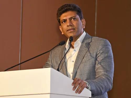
P. Narahari, Joint Secretary, Department of Land Resources, underscored the bilateral importance of the exchange. 'Land is not merely an administrative record; it is closely linked to livelihoods, economic activity, access to government benefits and citizens' sense of security. India's experience has been one of continuously modernising land administration through technology, while recognising the diversity of our States and their land systems. We are pleased to share these experiences with our Sri Lankan colleagues and equally look forward to learning from their institutional practices and reforms,' he said.
Amit Kumar Singh, Director (LR), DoLR, elaborated on the broader vision: 'The transformation of land records is not merely about converting paper records into digital form. The larger objective is to create an integrated land information ecosystem where textual records, spatial information, registration data and geospatial technologies complement each other.'
Bharat Land Stack and Paperless Registration
The delegation received a detailed walkthrough of the Bharat Land Stack, described as an integrated, GIS-based federated architecture that brings together satellite and drone imagery, georeferenced cadastral boundaries, Records of Rights, property registration data, master planning and zoning regulations, building approvals, restrictions and litigation, circle rates, and tenancy details. The visiting officials were also briefed on ongoing reforms towards paperless registration and automated mutation, under which registration information can be electronically transmitted to the relevant revenue authority — significantly reducing delays and the need for citizens to make repeated visits to government offices.
Urban Land Governance and NAKSHA
NAKSHA, India's initiative to strengthen urban land governance through modern geospatial technologies, was highlighted as a significant step in the modernisation agenda. Collectively, these systems represent a multi-layered approach to reforming a domain that directly affects access to credit, government welfare benefits, and dispute resolution for millions of citizens. This comes amid growing regional interest in technology-driven public administration, with India increasingly positioning itself as a model for digital governance reform among neighbouring and partner nations.
The exchange is expected to inform future bilateral cooperation in land administration, with both sides reportedly open to learning from each other's institutional practices.
Point of View
Bharat Land Stack, and DILRMP together represent a decade of unglamorous but consequential reform work. What the mainstream narrative misses is that Sri Lanka's interest is not purely academic: the country faces acute land tenure disputes and is seeking investable, tech-driven fixes as part of its broader economic recovery. India's willingness to share this architecture through NCGG is also soft power in action — positioning New Delhi as a governance exporter, not just an economic partner. The real test will be whether the exposure translates into replicable reform in Colombo or stays a goodwill visit.
NationPress
23 Sept 2026
Frequently Asked Questions
What did the Sri Lankan delegation come to study in India?
The delegation came to study India's large-scale land governance reforms, including digitisation of land records, spatial-textual integration, digital registration, geospatial identification of land parcels, computerisation of Revenue Courts, and urban land mapping. The visit was part of an exposure programme coordinated by the National Centre for Good Governance (NCGG).
What is the Digital India Land Records Modernisation Programme (DILRMP)?
DILRMP is India's flagship programme to digitise and modernise land records nationwide, covering computerisation of Records of Rights, integration of registration with land records, and the deployment of ULPIN (Bhu-Aadhaar). It aims to create a transparent, tech-driven land administration system that reduces delays and citizen visits to government offices.
What is ULPIN or Bhu-Aadhaar?
ULPIN, also called Bhu-Aadhaar, assigns a unique 14-digit alphanumeric identity to every land parcel in India based on its geospatial coordinates. It enables linkage of land parcels with other land-related datasets and maintains those linkages even when parcels are subdivided.
What is the Bharat Land Stack?
Bharat Land Stack is an integrated, GIS-based federated architecture that brings together satellite and drone imagery, georeferenced cadastral boundaries, Records of Rights, property registration data, master planning, zoning regulations, building approvals, circle rates, and tenancy details. It provides a single, unified view of land information across administrative layers.
Why is India sharing its land governance experience with Sri Lanka?
India and Sri Lanka share close bilateral ties, and the exchange is aimed at mutual learning in public administration. India's Department of Land Resources and the NCGG are increasingly facilitating such programmes to support regional capacity building, while also benefiting from understanding partner nations' institutional practices.