CM Himanta Flags Unprecedented Floods in Upper Assam

Synopsis
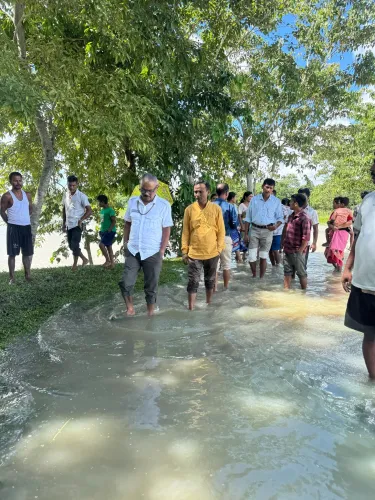
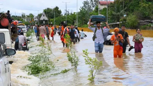
Assam Chief Minister Himanta Biswa Sarma on 21 July 2026 warned of historic flooding in Sivasagar, Jorhat and Charaideo districts, with water levels unseen in over 50 years following an upstream cloudburst. He urged affected residents to cooperate with authorities and relocate to safer areas.
Key Takeaways
Three Upper Assam districts — Sivasagar, Jorhat and Charaideo — are experiencing floods described as unprecedented in over half a century.
The flooding was triggered by a cloudburst upstream , causing water levels to surge across the Brahmaputra flood plain.
CM Himanta Biswa Sarma made a public appeal on 21 July 2026 urging affected families to follow official evacuation advisories.
The Assam State Disaster Management Authority (ASDMA) is the nodal agency coordinating relief and evacuation operations on the ground.
The region's tea gardens and workforce settlements face significant risk from prolonged inundation.
Possible requests for central assistance under SDRF/NDRF norms are expected once damage assessments are completed.
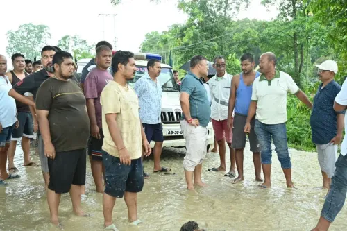
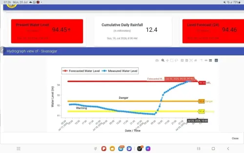
Assam Chief Minister Himanta Biswa Sarma on Tuesday, 21 July 2026, warned of unprecedented flooding across Sivasagar, Jorhat, and Charaideo districts in Upper Assam, saying water levels have reached highs unseen in over half a century following a cloudburst upstream.
Context
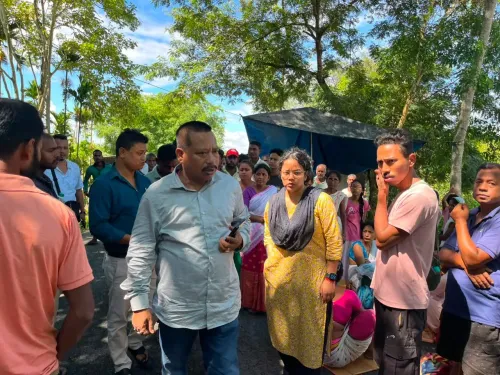
In his post, CM Sarma stated that the three Upper Assam districts are 'witnessing unprecedented flooding following the cloudburst upstream, with water levels unseen in over half a century.' He urged all affected families to 'cooperate with the authorities and move to safer locations when advised.' The appeal carries added urgency given the scale of inundation described.
Sivasagar, Jorhat, and Charaideo lie in the Brahmaputra flood plain and have historically been among the most flood-prone districts in the state. Charaideo is a relatively newly carved district that shares the same riverine vulnerability as its neighbours in the Upper Assam belt.
Policy Backdrop
The Assam State Disaster Management Authority (ASDMA), constituted in 2007, serves as the nodal agency for coordinating flood evacuations, relief camps, and damage assessments across the state. Its protocols include activating district-level response teams and liaising with central agencies for additional resources.
Assam experiences annual monsoon flooding driven by heavy upstream rainfall in Arunachal Pradesh and riverbank erosion along the Brahmaputra and its tributaries. Extreme rainfall events have grown more frequent across the Northeast, placing sustained pressure on embankments and early-warning infrastructure built over decades. A major flood cycle in 2017 had prompted large-scale National Disaster Response Force (NDRF) deployments and a fresh review of embankments across Upper Assam.
Stakeholders and Impact
Hundreds of families in Sivasagar, Jorhat, and Charaideo are directly in the path of the rising waters. The region is also home to a significant number of tea gardens, whose operations, infrastructure, and workforce settlements are acutely vulnerable to prolonged inundation.
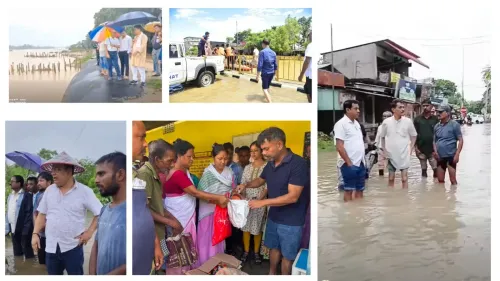
State authorities, including district administrations and ASDMA teams, are expected to be coordinating evacuations and setting up relief camps. The Central Water Commission monitors river-level data in real time and shares alerts with state governments to guide evacuation decisions.
What's Next
Damage assessments by ASDMA will determine whether the state formally requests central assistance under State Disaster Response Fund (SDRF) or NDRF norms. River-level updates from the Central Water Commission will be critical in deciding when evacuation advisories can be lifted.
With the monsoon still weeks from its peak, the situation in Upper Assam will test the state's disaster infrastructure and inter-agency coordination — and may renew calls for accelerated embankment upgrades and upstream rainfall-monitoring systems across the Northeast.
Point of View
Not routine monsoon pressure. By personally urging cooperation with evacuation orders, he is also managing public behaviour proactively, a pattern seen in previous high-stakes flood seasons when delayed evacuations worsened casualties. The episode fits a broader arc of the Northeast grappling with intensifying extreme-weather events that outpace existing embankment and early-warning infrastructure. How quickly ASDMA and central agencies mobilise, and whether the Centre fast-tracks NDRF support, will be a political and administrative test for the BJP government in Assam.
NationPress
21 Jul 2026
Frequently Asked Questions
Which districts in Assam are flooded in July 2026?
Sivasagar, Jorhat and Charaideo districts in Upper Assam are experiencing severe flooding as of 21 July 2026, according to Chief Minister Himanta Biswa Sarma.
What caused the floods in Upper Assam in July 2026?
CM Sarma attributed the flooding to a cloudburst upstream that caused water levels to rise to highs not seen in over half a century.
What has the Assam government advised flood-affected residents?
CM Himanta Biswa Sarma urged all affected families to cooperate with authorities and move to safer locations when advised to do so.
What is ASDMA and what role does it play in Assam floods?
The Assam State Disaster Management Authority (ASDMA), set up in 2007, is the nodal agency for coordinating flood evacuations, relief camps and damage assessments across the state.
Can the Assam government get central funds for flood relief?
Yes, the state can formally request central assistance under State Disaster Response Fund (SDRF) or National Disaster Response Fund (NDRF) norms once official damage assessments are submitted to the Centre.